MyTopo
Deerfield Tennessee US Topo Map
Couldn't load pickup availability
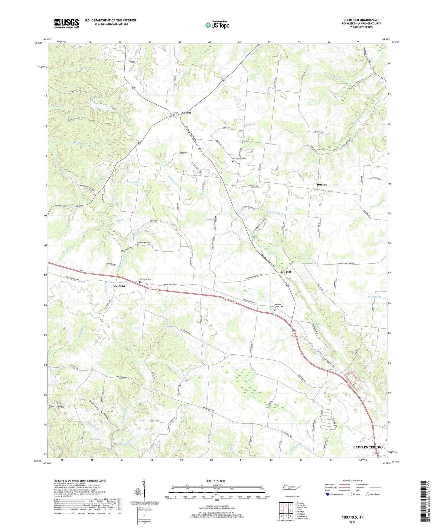
2022 topographic map quadrangle Deerfield in the state of Tennessee. Scale: 1:24000. Based on the newly updated USGS 7.5' US Topo map series, this map is in the following counties: Lawrence. The map contains contour data, water features, and other items you are used to seeing on USGS maps, but also has updated roads and other features. This is the next generation of topographic maps. Printed on high-quality waterproof paper with UV fade-resistant inks.
Quads adjacent to this one:
West: Ovilla
Northwest: Riverside
North: Henryville
Northeast: Summertown
East: Ethridge
Southeast: Lawrenceburg
South: Long Branch
Southwest: Westpoint
This map covers the same area as the classic USGS quad with code o35087c4.
Contains the following named places: Bradley Hollow, Burns Branch, Center, Center School, Commissioner District 15, Deerfield, Deerfield Baptist Church, Deerfield Cemetery, Deerfield Church of Christ, Deerfield Division, Deerfield School, Dry Branch, Dryden Branch, Greenwood Cemetery, Greenwood Church, Howardville School, Hudson, Hudson School, Kelly Spring, Kelly Spring Branch, Kidd Branch, Kilburn Hollow, Lourdes Lake, Lutts Branch, Macedonia Cemetery, Macedonia Church, Midway Church, Mount Lebanon School, O K Missionary Baptist Church, O K School, Park Grove Church, Parker Branch, Patterson Branch, Pleasant Grove Cemetery, Pleasant Grove Church, Red Hill, Sowell Branch, Sowers Branch, Spring Branch, Sunnybrook Creek, Theasing Branch, Veterans of Foreign Wars Dam, Veterans of Foreign Wars Lake, VFW Lake, Wolfpen Branch, ZIP Code: 38464