MyTopo
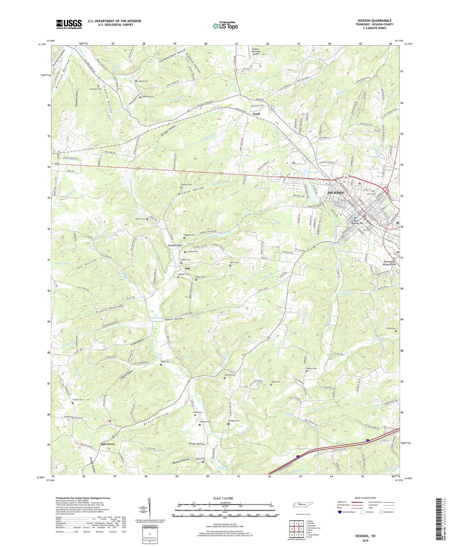
Dickson Tennessee US Topo Map
Couldn't load pickup availability
2022 topographic map quadrangle Dickson in the state of Tennessee. Scale: 1:24000. Based on the newly updated USGS 7.5' US Topo map series, this map is in the following counties: Dickson. The map contains contour data, water features, and other items you are used to seeing on USGS maps, but also has updated roads and other features. This is the next generation of topographic maps. Printed on high-quality waterproof paper with UV fade-resistant inks.
Quads adjacent to this one:
West: Tennessee City
Northwest: Ruskin
North: Vanleer
Northeast: Charlotte
East: Burns
Southeast: Lyles
South: Texas Hollow
Southwest: Spot
This map covers the same area as the classic USGS quad with code o36087a4.
Contains the following named places: Adams Cemetery, Assembly of Little Flock Primitive Baptist Church, Baker Branch, Baker Cemetery, Baker Spring, Beech Grove, Beech Grove School, Bethel Church, Big Branch, Bowmans Chapel United Methodist Church, Bruce Cemetery, Bruce Hollow, Bruce Spring, Campbell Hollow, Center Avenue Hill, Chester Cemetery, Chester Hollow, Church of the Nativity Episcopal, Clifton Cemetery, Coaling School, Commissioner District 2, Commissioner District 8, Commissioner District 9, Coon Creek, Dickson, Dickson County Ambulance Service, Dickson County Fire and Rescue Squad, Dickson County High School, Dickson Cumberland Presbyterian Church, Dickson Division, Dickson Elementary School, Dickson Fire Department, Dickson Golf and Country Club, Dickson Junior High School, Dickson Lake, Dickson Missionary Baptist Church, Dickson Municipal Building, Dickson Police Department, Dickson Post Office, Donegan Cemetery, Donegan Crossing, Donegan Spring, Dry Hollow Branch, East Dickson, East Piney River, Edwards Cemetery, England Bluff, England Cemetery, Eno, Eno School, Eno United Methodist Church, Fannie Branch, Fielder Branch, Fielder Cemetery, Fielder Spring, First Presbyterian Church, First United Methodist Church, Forks of Piney, Fuqua Hollow, Gilliam Hollow, Grab Creek, Gray Hollow, Hampton High School, Harrell Cemetery, Hendricks Church, Hendricks School, Hillcrest, Hillcrest School, Hillview Baptist Church, Indian Pond, J Dan Buckner Park, J E Sullivan Middle School, Kingdom Hall of Jehovahs Witnesses, Lamastus Cemetery, Locke Hollow, Martin Cemetery, Moore Hollow, Mount Sinai, Mount Zion Church, Mount Zion School, New City Lake, New City Lake Dam, New Hope Church, Oak Avenue Church of Christ, Oak Grove, Oak Grove School, Oak Grove United Methodist Church, Oakmont Elementary School, O'Ferrell Cemetery, Opossum Hollow, Orebank Hollow, Original Church of God, Piney Furnace, Piney River Church, Plum Orchard Hollow, Pond, Pond Church, Pond School, Redden Branch, Redden Spring, Robinson Chapel Freewill Baptist Church, Robinsons Chapel, Saint Christopers Catholic Church, Saint James African Methodist Episcopal Church, Saint James Episcopal Church, Spring Branch, Springer Hollow, Standing Rock Hollow, Sullivan Cemetery, Sycamore Church, Sycamore School, Tab Hollow, Tennessee City Division, Tennessee City Volunteer Fire Department Station 2, Trestle Hollow, TriStar Horizon Medical Center, Union Cemetery, Vineyard Cemetery, Walnut Grove Baptist Church, Walnut Grove School, Walnut Grove Spring, Walnut Street Church of Christ, Water Valley, Water Valley Primitive Baptist Church, Water Valley School, Weems Cemetery, West Dickson, West Dickson Church of Christ, West Piney River, Wildcat Hollow, Wiley Branch, Willow Branch, Wills Cemetery, Worley Furnace, Worley Furnace Branch, Worley Furnace Mines, Worley Furnace Missionary Baptist Church, Yates Cemetery, ZIP Code: 37055


