MyTopo
Dry Valley Tennessee US Topo Map
Couldn't load pickup availability
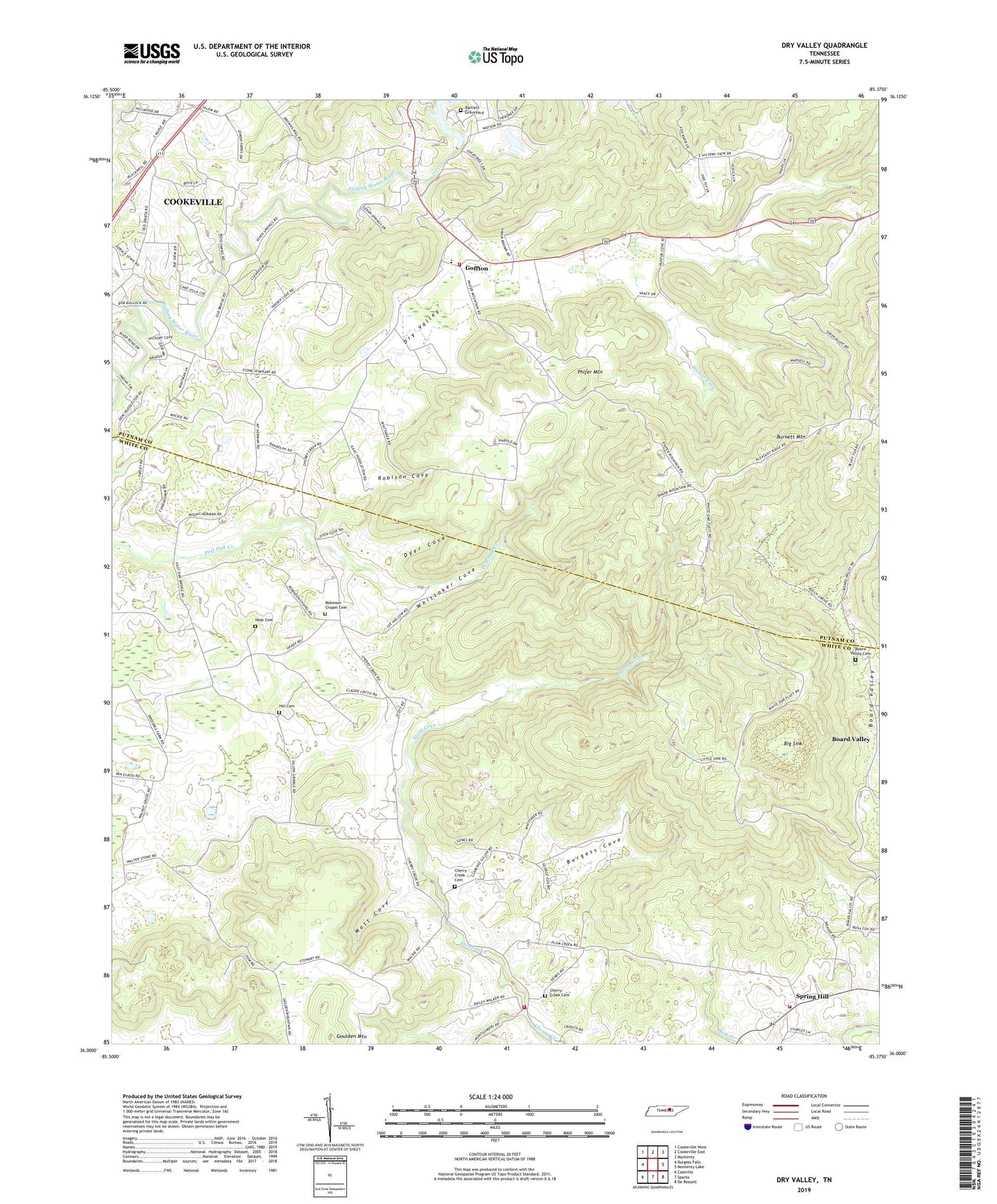
2019 topographic map quadrangle Dry Valley in the state of Tennessee. Scale: 1:24000. Based on the newly updated USGS 7.5' US Topo map series, this map is in the following counties: White, Putnam. The map contains contour data, water features, and other items you are used to seeing on USGS maps, but also has updated roads and other features. This is the next generation of topographic maps. Printed on high-quality waterproof paper with UV fade-resistant inks.
Quads adjacent to this one:
West: Burgess Falls
Northwest: Cookeville West
North: Cookeville East
Northeast: Monterey
East: Monterey Lake
Southeast: De Rossett
South: Sparta
Southwest: Cassville
Contains the following named places: Bartlett Graveyard, Beech Grove Church, Big Sink, Board Valley, Board Valley Cemetery, Board Valley Church, Bohannon School, Bridge Church, Browns Mill Church, Burgess Cove, Burnett, Burnett Mountain, Burnett School, Caney Fork Church, Cherry Creek, Cherry Creek Cemetery, Cherry Creek Church, Cherry Creek Volunteer Fire Department, Cherry Creek Volunteer Fire Department Station 2 Spring Hill, Commissioner District 3, Commissioner District 5, Dry Valley, Dry Valley Church, Dry Valley School, Dyer Cove, East Lake Estates, Fountain Head School, Goffton, Goulden Mountain, Hill Cemetery, Hillwood, Hunter Cove, Key, Maddux Farm, Mott Cove, Mount Herman, Mount Herman School, Mount Heron Church, Nash Cemetery, Peekville, Phifer Mountain, Phifer Mountain Church, Pleasant Ridge, Pleasant Ridge Church, Putnam County Fire Department Station 15, Robinson Chapel, Robinson Chapel Cemetery, Robison Cove, Spring Hill, Spring Hill Presbyterian Church, Stone Cove, Stone Seminary, Wagonda Hills, Walnut Grove, Walnut Grove Church, White County Highway Department Quarry, White Oak Flatt School, Whittaker Cove, Woodland Estates