MyTopo
Eads Tennessee US Topo Map
Couldn't load pickup availability
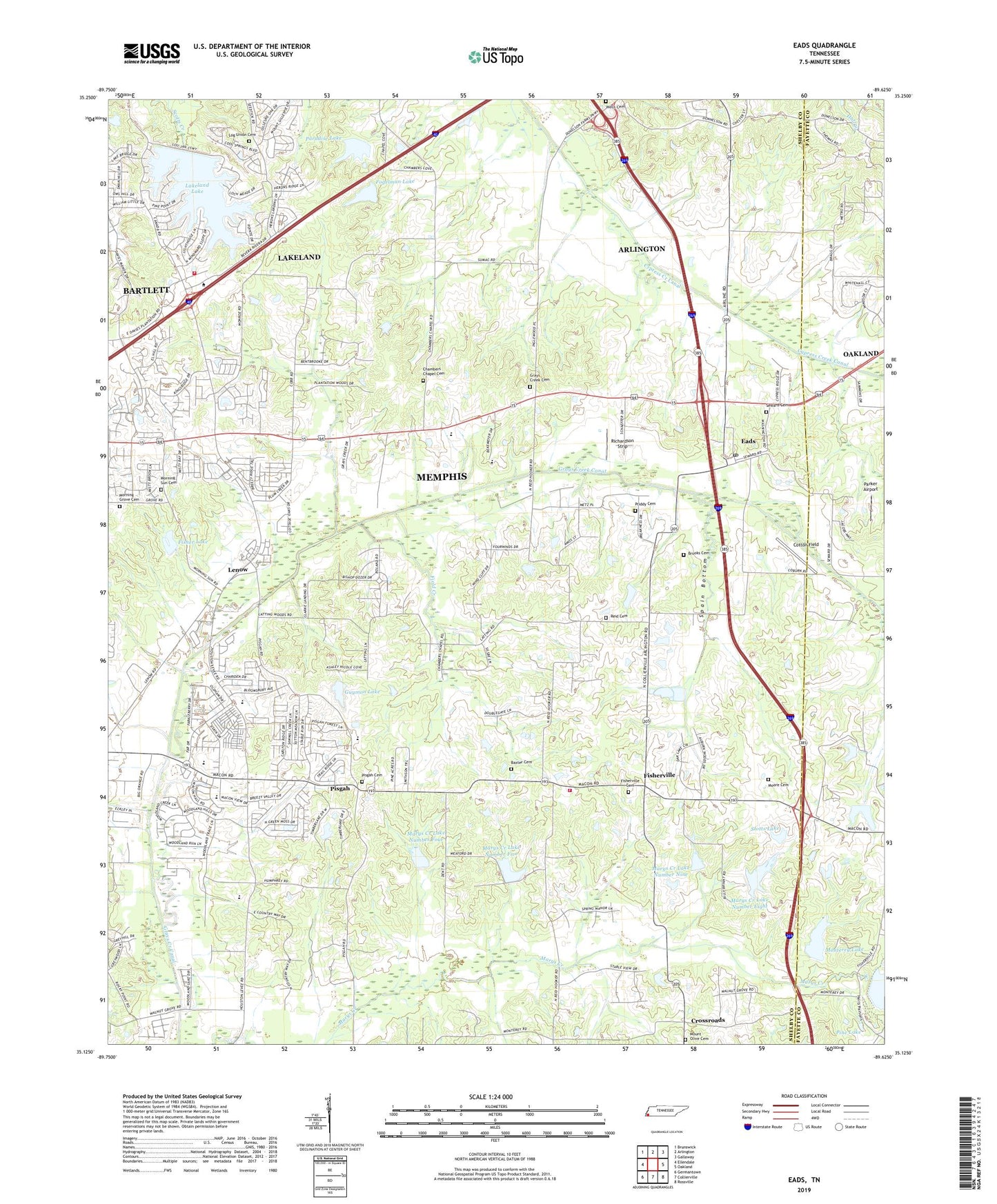
2022 topographic map quadrangle Eads in the state of Tennessee. Scale: 1:24000. Based on the newly updated USGS 7.5' US Topo map series, this map is in the following counties: Shelby, Fayette. The map contains contour data, water features, and other items you are used to seeing on USGS maps, but also has updated roads and other features. This is the next generation of topographic maps. Printed on high-quality waterproof paper with UV fade-resistant inks.
Quads adjacent to this one:
West: Ellendale
Northwest: Brunswick
North: Arlington
Northeast: Gallaway
East: Oakland
Southeast: Rossville
South: Collierville
Southwest: Germantown
This map covers the same area as the classic USGS quad with code o35089b6.
Contains the following named places: Baxter Cemetery, Brooks Cemetery, Chambers Chapel, Chambers Chapel Cemetery, Cotton Field, Crossroads, Cypress Creek Canal, Cypress Creek Church, Eads, Eads Post Office, Eads School, Field Creek, First Baptist Church of Fisherville, Fisher Dam, Fisher Lake, Fisherville, Fisherville Cemetery, Fisherville Division, Fisherville Farms, Fogelman Dam, Fogelman Lake, Friendship Temple, Grays Creek Canal, Grays Creek Cemetery, Grays Creek Church, Guymon Lake, Guymon Lake Dam, Herb Parsons Lake Dam, Horse Crazy Farms, James School, Lakeland, Lakeland Dam, Lakeland Factory Outlet Mall Shopping Center, Lakeland Fire Station 1, Lakeland Lake, Lenow, Log Union Cemetery, Log Union Church, Log Union School, Marys Creek Dam Number Eight, Marys Creek Dam Number Five, Marys Creek Dam Number Four, Marys Creek Dam Number Nine, Marys Creek Lake Number Eight, Marys Creek Lake Number Five, Marys Creek Lake Number Four, Marys Creek Lake Number Nine, Marys Creek Pilot Watershed Dam Number Two, Monterey Lake, Moore Cemetery, Moores School, Morning Grove Cemetery, Morning Grove Church, Morning Sun Cemetery, Morning Sun Church, Morris Lookout Tower, Mount Olive Cemetery, Mount Olive Church, Mount Pisgah High School, Paradise Lake, Paradise Lake Dam, Parker Airport, Patricia Shaw Pumping Station Water Treatment Plant, Pine Lake, Pisgah, Pisgah Cemetery, Pisgah Church, Price School, Priddy Cemetery, Reid Cemetery, Richardson Strip, Rocky Point, Seward Cemetery, Shelby County Fire Department Station 61, Spain Bottom, Stotts Lake, Stotts Lake Dam, Wells Cemetery, Wells School, ZIP Code: 38028