MyTopo
Erin Tennessee US Topo Map
Couldn't load pickup availability
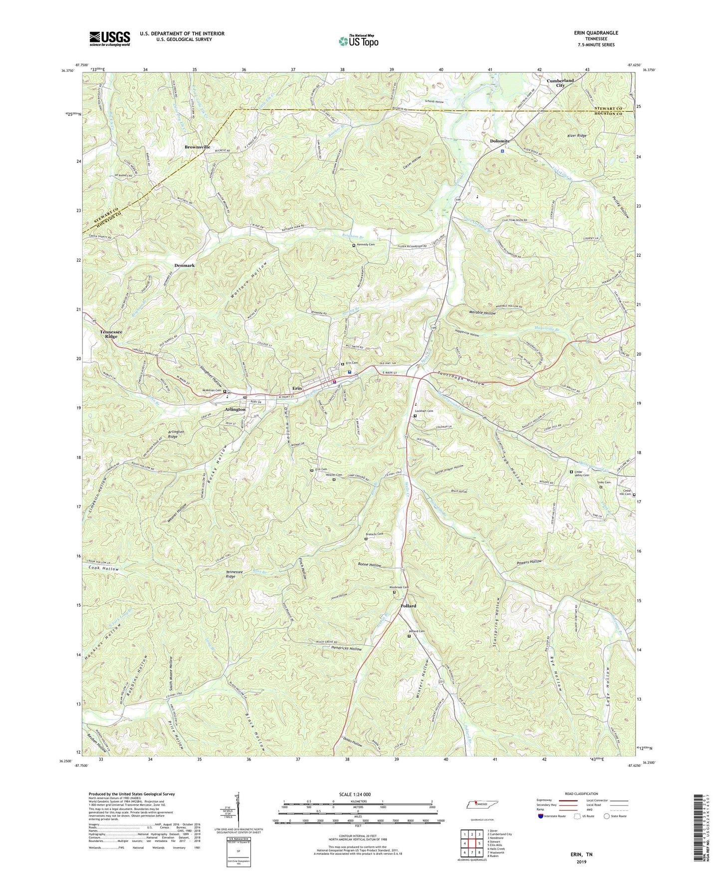
2022 topographic map quadrangle Erin in the state of Tennessee. Scale: 1:24000. Based on the newly updated USGS 7.5' US Topo map series, this map is in the following counties: Houston, Stewart. The map contains contour data, water features, and other items you are used to seeing on USGS maps, but also has updated roads and other features. This is the next generation of topographic maps. Printed on high-quality waterproof paper with UV fade-resistant inks.
Quads adjacent to this one:
West: Stewart
Northwest: Dover
North: Cumberland City
Northeast: Needmore
East: Ellis Mills
Southeast: Ruskin
South: Woolworth
Southwest: Halls Creek
This map covers the same area as the classic USGS quad with code o36087c6.
Contains the following named places: Alsobrooks Cemetery, Arlington, Arlington Ridge, Arlington School, Ashland Furnace, Averitt Branch, Bateman Branch, Bateman School, Beech Hollow, Black Hollow, Boone Hollow, Booster Branch, Bratschi Cemetery, Brigham Branch, Brigham Cemetery, Brownsville, Byron Forge, Campground Church, Campground School, Carter Hollow, Cave Orchard Branch, Cave Orchard School, Cedar Hill Cemetery, Cedar Hill School, Cedar Valley Cemetery, Cedar Valley Church, City of Erin, Clark Branch, Commissioner District 3, Commissioner District 4, Commissioner District 6, Denmark, Denmark School, Dobbs Hollow, Dolomite, Erin, Erin Branch, Erin Cemetery, Erin City Hall, Erin Division, Erin Elementary School, Erin Fire Department, Erin Police Department, Erin Post Office, Finch Hollow, Hagerville Branch, Haggieville Hollow, Hendricks Hollow, Houston County, Houston County Ambulance Service, Houston County Community Hospital, Houston County Courthouse, Houston County High School, Houston County Sheriff's Office, Jennie Hollow, Kizer Ridge, Lickskillet Branch, Lockart Chapel, Lockhart Cemetery, Long Branch School, Marable Hollow, Mcmillian Cemetery, Midway, Mount Sinai Church, Mount Zion Church, Musterground Creek, Owl Hollow, Peach Grove Church, Pollard, Pollard Branch, Pollard Cemetery, Pollard School, Powers Hollow, Price Hollow, Pulley Hollow, Reuben Hollow, Robbins Hollow, Rocky Hollow, Ross Branch, Rye Hollow, Sage Hollow, Schmid Airport, Schmidt Hollow, Secret Prayer Hollow, Sinks Cemetery, Slaughter Hollow, South Moore Hollow, Spring Branch, Starspring Hollow, Steels Chapel, Tab Hollow, Tantrough Hollow, Tennessee Department of Agriculture Division of Forestry Erin Fire Tower, Union Furnace, Wallace Hollow, Weaver Cemetery, Weaver Hollow, Winters Hollow, ZIP Codes: 37050, 37061