MyTopo
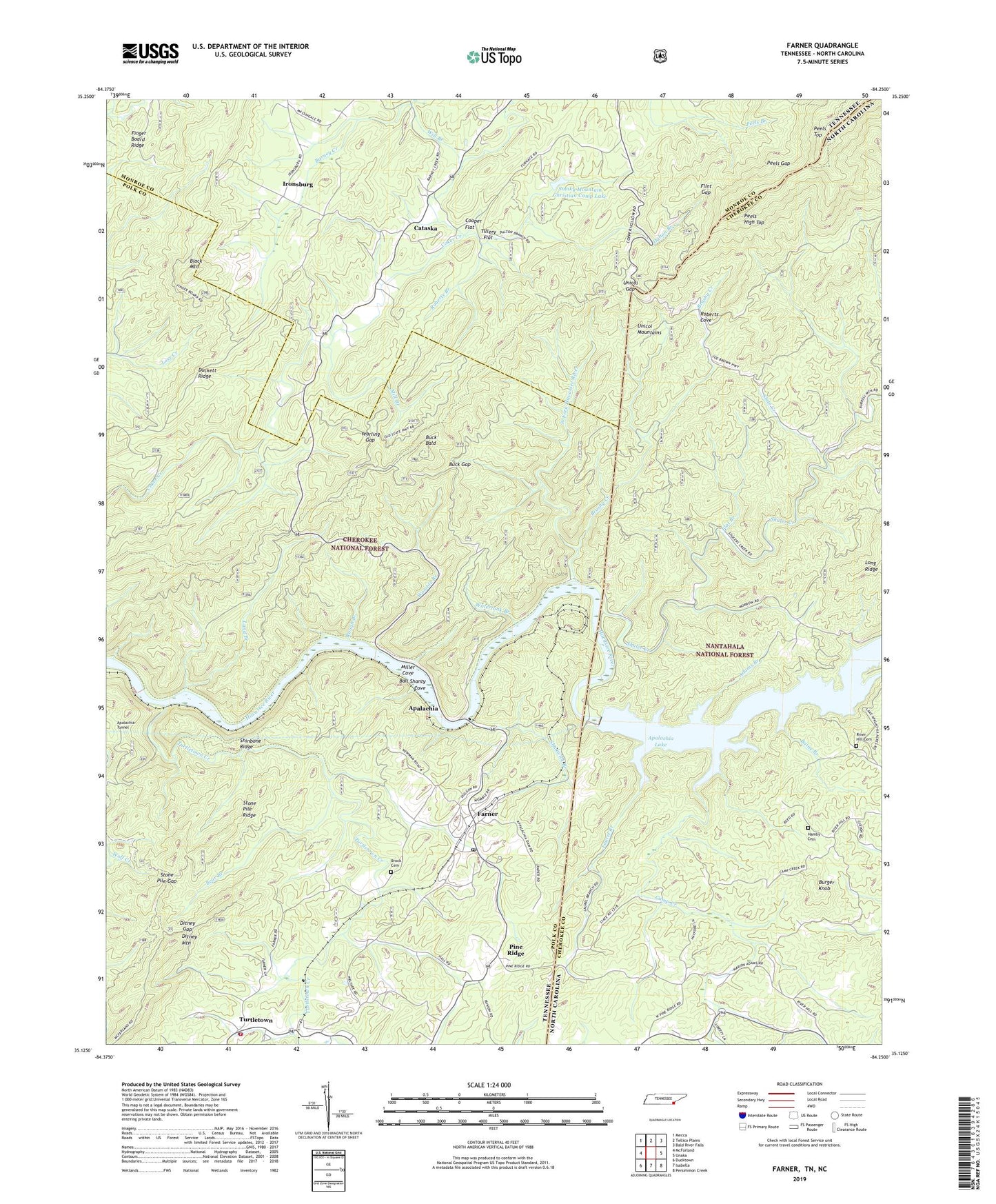
Farner Tennessee US Topo Map
Couldn't load pickup availability
Also explore the Farner Forest Service Topo of this same quad for updated USFS data
2022 topographic map quadrangle Farner in the states of Tennessee, North Carolina. Scale: 1:24000. Based on the newly updated USGS 7.5' US Topo map series, this map is in the following counties: Polk, Cherokee, Monroe. The map contains contour data, water features, and other items you are used to seeing on USGS maps, but also has updated roads and other features. This is the next generation of topographic maps. Printed on high-quality waterproof paper with UV fade-resistant inks.
Quads adjacent to this one:
West: McFarland
Northwest: Mecca
North: Tellico Plains
Northeast: Bald River Falls
East: Unaka
Southeast: Persimmon Creek
South: Isabella
Southwest: Ducktown
This map covers the same area as the classic USGS quad with code o35084b3.
Contains the following named places: Adams Branch, Alvin Branch, Apalachia, Apalachia Dam, Apalachia Tunnel, Baine Branch, Ball Shanty Cove, Barney Creek, Bear Branch, Black Mountain, Brannon Prospect, Brock Cemetery, Brushy Creek, Buck Bald, Buck Bald Lookout, Buck Gap, Burger Knob, Calico Workings, Calvary Baptist Church, Camp Creek, Cataska, Cataska School, Cooper Branch, Cooper Flat, Cooper Mine, Dalton Branch, Ditney Gap, Ditney Mountain, Duckett Ridge, Duckett Ridge Mine, East Fork Wolf Creek, East Polk County Fire and Rescue Station 2, El Tigre Placer Mine, Farner, Farner Census Designated Place, Farner Post Office, Flat Branch, Flint Gap, Hamby Cemetery, Headwaters of Cooper Branch Mine, Hiwassee, Hollinghead Field Workings, Ironsburg, Ironsburg United Methodist Church, Land Branch, Laurel Branch, Mill Branch, Mill Branch Workings, Miller Cove, Mountain Spur, Northeast Lonsdale Mine, Northeast Roberts Branch Mine, Northwest Lonsdale Mine, Paris Mine, Peels Gap, Peels High Top, Peels Top, Pine Ridge, Poindexter Church, Prince Ferry, River Hill Cemetery, Roberts Branch, Roberts Cove, Rough Branch, Shadwick Branch, Shinbone Ridge, Shuler Creek, Slate Creek, Smoky Mountain Christian Camp Lake, Smoky Mountain Christian Camp Lake Dam, Southeast Lonsdale Mine, Southwest Lonsdale Mine, Southwest Roberts Branch Mine, Stone Pile Gap, Stone Pile Ridge, The Loop, Tillery Flat, Turtletown, Turtletown Baptist Church, Turtletown Creek, Turtletown Division, Turtletown Elementary School, Turtletown Post Office, Unicoi Gap, Unicoi Mountain Trail, Unicoi Trail, Watertank Branch, West Fork Hiwassee River, Will Branch, Womble Branch, Yearling Gap, ZIP Code: 37333