MyTopo
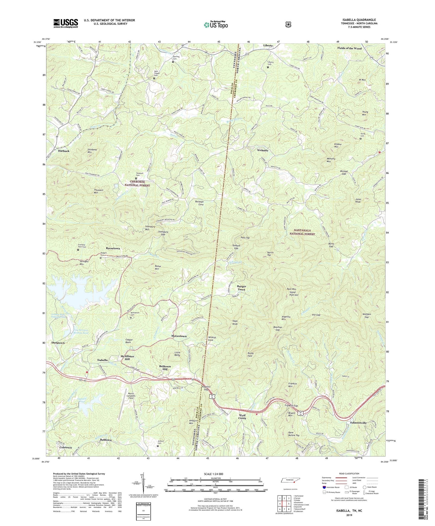
Isabella Tennessee US Topo Map
Couldn't load pickup availability
Also explore the Isabella Forest Service Topo of this same quad for updated USFS data
2022 topographic map quadrangle Isabella in the states of Tennessee, North Carolina. Scale: 1:24000. Based on the newly updated USGS 7.5' US Topo map series, this map is in the following counties: Polk, Cherokee. The map contains contour data, water features, and other items you are used to seeing on USGS maps, but also has updated roads and other features. This is the next generation of topographic maps. Printed on high-quality waterproof paper with UV fade-resistant inks.
Quads adjacent to this one:
West: Ducktown
Northwest: McFarland
North: Farner
Northeast: Unaka
East: Persimmon Creek
Southeast: Culberson
South: Mineral Bluff
Southwest: Epworth
This map covers the same area as the classic USGS quad with code o35084a3.
Contains the following named places: Amburn Cemetery, Amburn Mountain, Angelico Gap, Angelico Mountain, Arp Gap, Belltown, Belltown Hill, Bethleham Church, Bethlehem Cemetery, Bethlehem Church, Boonville, Bowman Gap, Bryant Mountain, Buckeye Cove, Burger Town, Burns Gap, Burra-Burra Creek, Calloway Mines, Cities Services Dam, City Services Rention Pond, City Services Retention Dam, Coletown, Copper Basin, Croft Chapel, Dave Bellew Top, East Polk County Fire and Rescue Station 6, Ellis Branch, Eureka Mine, Fields of the Wood, Franklin Gap, Franklin Mountain, Freeland Town Cemetery, Gypsum Dam, Gypsum Pond, Hall Creek, Harbuck, Harris Top, Hays Knob, Hiwassee Dam Volunteer Fire Department Substation, Isabella, Isabella Baptist Church, Isabella Mine, Isabella School, Jarnigan Mountain, Johnsonville, Jones Knob, Kildeer Mountain, Kimsey, Kimsey School, Liberty, Liberty Cemetery, Little Baldy, London Flotation Plant, London Mills Tailings Pond, London Mills Tailings Pond Dam, Long Branch, Macedonia Church, Maple Grove Church, Martin Campbell Field, McAllister Hill, McGeetown, McPherson Mine, Michael Gap, Mount Carmel Church, Mount Harmony Church, Mount Moriah Church, Mount Olive Church, Mount Vernon Church, Neal Chapel Cemetery, Negro Creek, New Hope Church, Pack Gap, Pack Mountain, Pack Top, Padgett Cemetery, Reese Mountain, Reesetown, Rocky Face, Rocky Ford Creek, Shinbone Mountain, Shoal Creek Church, Signal Pole Hill, Simonds Chapel, Spurling Cemetery, Stansbury Gap, Stansbury Mountain, Stewardtown, Swanson Church, Tanbark Gap, Temple Church, Threewit Cemetery, Threewit Mountain, Township of Hothouse, Wehutty, Wehutty Church, Wehutty Mountain, West Mountain, Wildcat Cove, Willow Springs School, Wolf Creek, Wolf Creek Fire and Rescue Department - Station 23, Wolfpen Gap, Young Cemetery, Young Mountain, Zion Hill Church, ZIP Code: 37391