MyTopo
Hickory Flat Kentucky US Topo Map
Couldn't load pickup availability
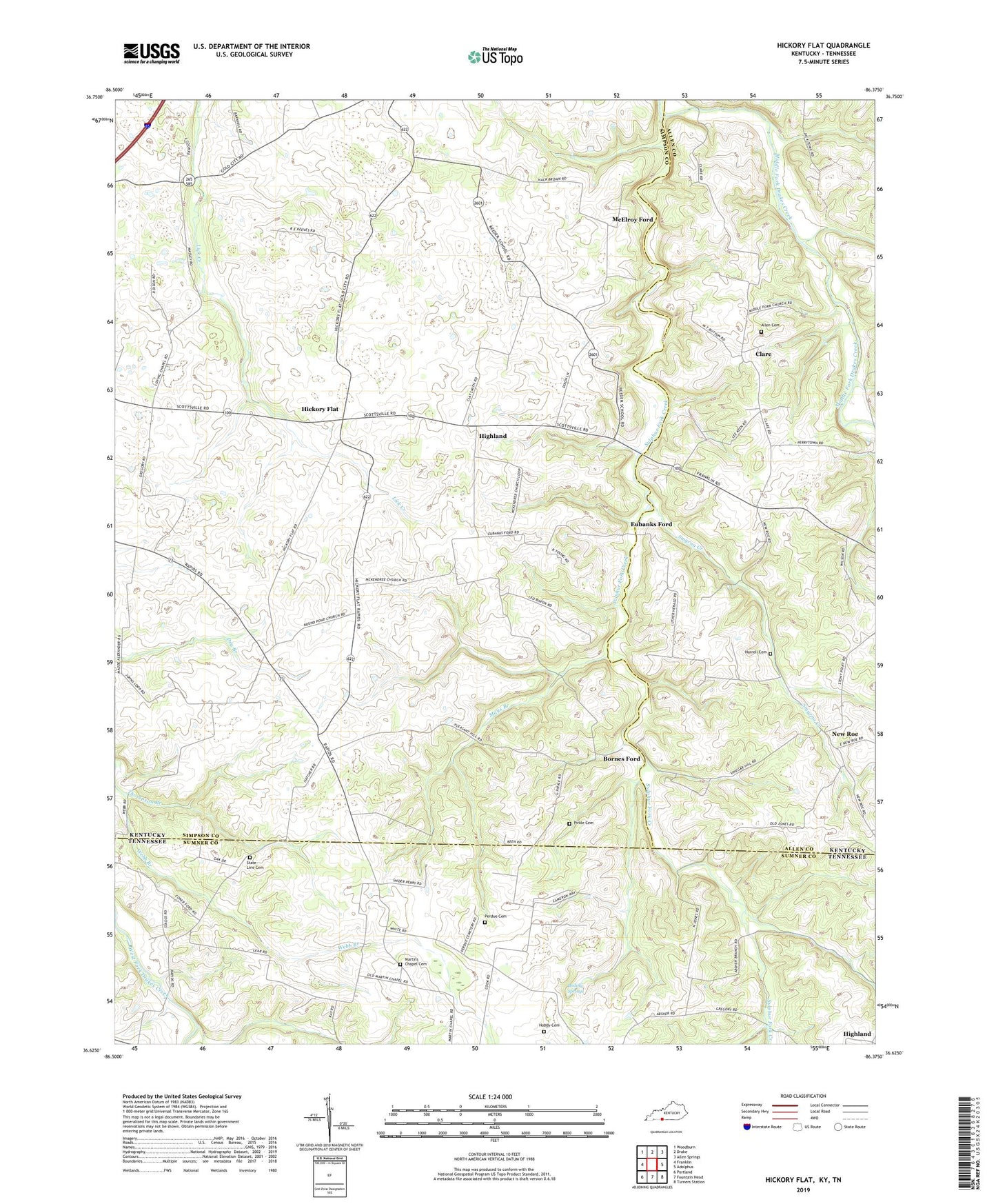
2022 topographic map quadrangle Hickory Flat in the states of Kentucky, Tennessee. Scale: 1:24000. Based on the newly updated USGS 7.5' US Topo map series, this map is in the following counties: Simpson, Allen, Sumner. The map contains contour data, water features, and other items you are used to seeing on USGS maps, but also has updated roads and other features. This is the next generation of topographic maps. Printed on high-quality waterproof paper with UV fade-resistant inks.
Quads adjacent to this one:
West: Franklin
Northwest: Woodburn
North: Drake
Northeast: Allen Springs
East: Adolphus
Southeast: Turners Station
South: Fountain Head
Southwest: Portland
Contains the following named places: Allen Cemetery, Bethany Church, Boiling Springs, Bornes Ford, Clare, East Simpson Division, Eubanks Ford, Harrell Cemetery, Hickory Flat, Highland, Hobdy Cemetery, Hop Over, Loving Chapel, Martins Chapel Cemetery, Martins Church, Mays Branch, McElroy Ford, McKendree Church, Middle Fork Church, New Roe, Perdue Cemetery, Pirkle Cemetery, Pleasant Hill Church, Rapids, Round Pond, Round Pond Church, Round Pond Elementary School, Shady Grove Baptist Church, Smyrna, Smyrna Creek, Smyrna Cumberland Presbyterian Church, State Line Cemetery, State Line Church, Sulphur Fork Creek, Thompson Branch