MyTopo
Fox Creek Tennessee US Topo Map
Couldn't load pickup availability
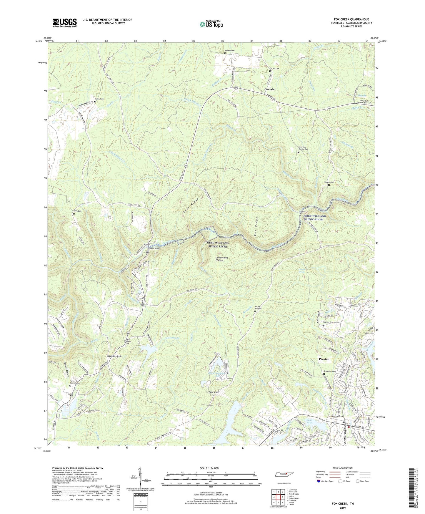
2019 topographic map quadrangle Fox Creek in the state of Tennessee. Scale: 1:24000. Based on the newly updated USGS 7.5' US Topo map series, this map is in the following counties: Cumberland. The map contains contour data, water features, and other items you are used to seeing on USGS maps, but also has updated roads and other features. This is the next generation of topographic maps. Printed on high-quality waterproof paper with UV fade-resistant inks.
Quads adjacent to this one:
West: Isoline
Northwest: Clarkrange
North: Jones Knob
Northeast: Twin Bridges
East: Hebbertsburg
Southeast: Ozone
South: Dorton
Southwest: Crossville
Contains the following named places: Adams Bridge, Adams Creek, Alpine Acres, Babcock Hollow, Bee Branch, Bee Ridge, Bob Branch, Brookhart Cemetery, Catherine Lake, Catherine Lake Dam, Catoosa Canyon, Catoosa Country, Cindy Creek, Commissioner District 4, Cove Ridge, Crossville North Division, Derrick Spring, Dogleg Branch, Druid Hills, Elmore Branch, Elmore Cemetery, Elmore Creek, Fairfield Glade, Fairfield Glade Fire Department Main Station, Fairfield Glade Post Office, Flatrock Branch, Forest Hill, Forest Hill Cemetery, Forest Hill Church, Forest Hill School, Fox Creek, Fox Creek Lake Dam, Frances Lake, Frances Lake Dam, Genesis, Genesis School, Good Neighbor Lake, Good Neighbor Lake Dam, Goss Cemetery, Gulden Cemetery, Hanby Branch, Henry Cemetery, Henry Ford, Laurel Branch, Lavender Branch, Lavender Knob, Lick Ridge, Linger Lake, Linger Lake Dam, Long Branch, Mill Creek, Mill Creek School, Neal Chapel, North Fork Elmore Creek, Peavine, Peavine Cemetery, Pilot Knob, Piney Branch, Potter Ford, Rough Mountain Branch, Ryan Lake, Scantling Branch, Scott Creek, Shiloh Church, Shiloh School, Shoal Creek, Sims Cemetery Number Two, Slate Springs, Slate Springs Baptist Church, Slate Springs Cemetery, Slate Springs School, South Fork Elmore Creek, Sugarcamp Branch, Three Fork, Turkey Knob, Turner Cemetery, Turner Cemetery Number One, Turner Cemetery Number Three, Underwood Branch, Whitepine Branch, Wiltshire, Wolfpen Branch, Woodlands