MyTopo
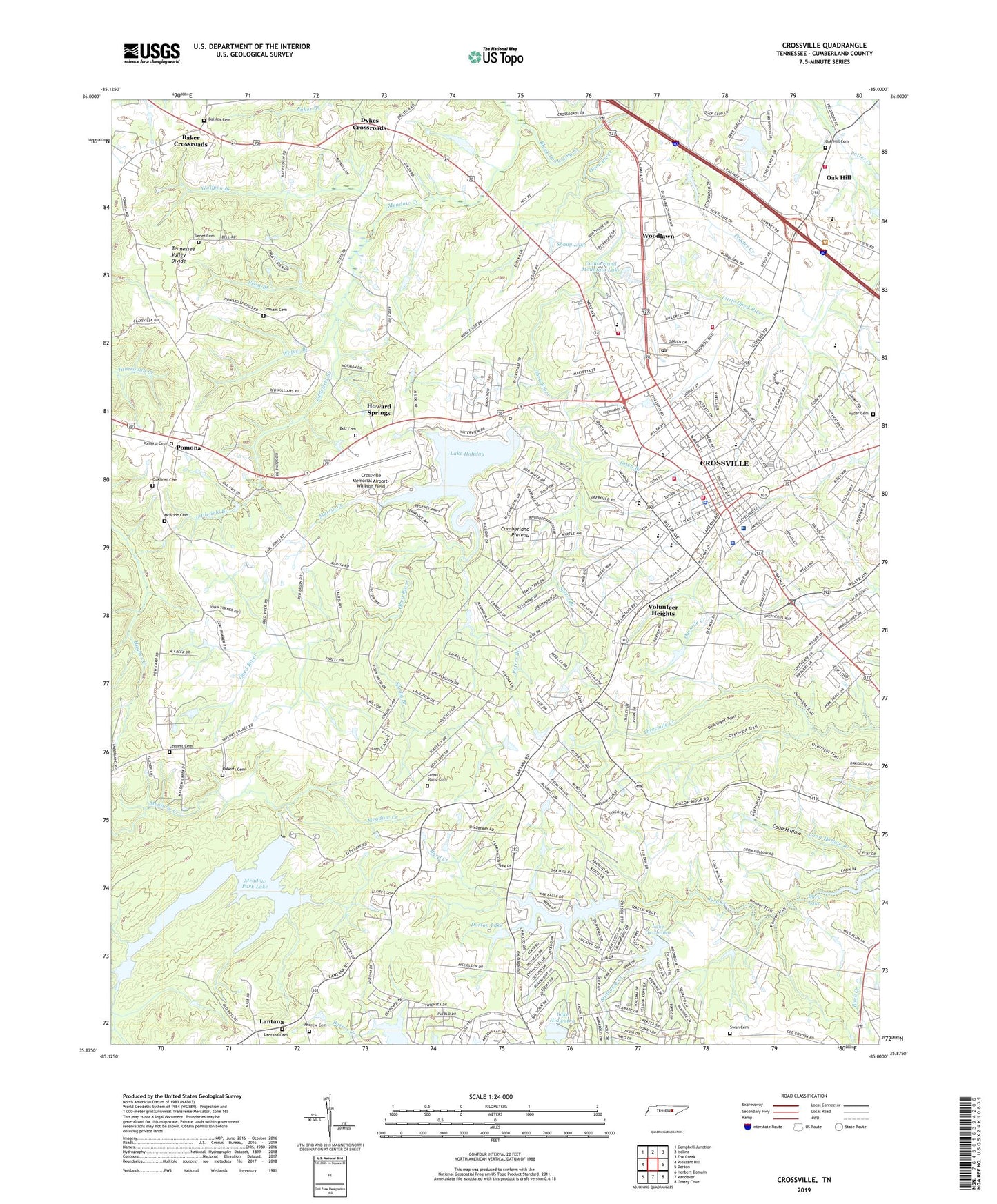
Crossville Tennessee US Topo Map
Couldn't load pickup availability
2023 topographic map quadrangle Crossville in the state of Tennessee. Scale: 1:24000. Based on the newly updated USGS 7.5' US Topo map series, this map is in the following counties: Cumberland. The map contains contour data, water features, and other items you are used to seeing on USGS maps, but also has updated roads and other features. This is the next generation of topographic maps. Printed on high-quality waterproof paper with UV fade-resistant inks.
Quads adjacent to this one:
West: Pleasant Hill
Northwest: Campbell Junction
North: Isoline
Northeast: Fox Creek
East: Dorton
Southeast: Grassy Cove
South: Vandever
Southwest: Herbert Domain
This map covers the same area as the classic USGS quad with code o35085h1.
Contains the following named places: Andrew Cemetery, Baisley Cemetery, Baker Crossroads, Bakers Crossroads Freewill Baptist Church, Bakers School, Bell Cemetery, Black Drowning Creek, Brookhaven, Byrd Creek Dam, Byrd Creek Lake, Byrd Lake, Calvary Temple Church, Camelot, Central Baptist Church, City of Crossville, Commissioner District 1, Commissioner District 2, Coon Hollow, Crossville, Crossville Church of Christ, Crossville Church of God of Prophecy, Crossville Division, Crossville Elementary School, Crossville Estates, Crossville Fire Department Headquarters Station, Crossville Fire Department Station 2, Crossville Freewill Baptist Church, Crossville Memorial Airport-Whitson Field, Crossville Police Department, Crossville Post Office, Crossville Seventh Day Adventist Church, Cumberland Camp Ground, Cumberland County Ambulance Service, Cumberland County Emergency and Rescue Services Squad, Cumberland County Fire Department, Cumberland County Fire Department Station 4, Cumberland County High School, Cumberland County Playhouse, Cumberland County Sheriff's Department, Cumberland Heights, Cumberland Medical Center, Cumberland Mountain Lake, Cumberland Mountain School, Cumberland Mountain State Park, Dooley Street Missionary Baptist Church, Dorton Lake, Dorton Lake Dam, Dunrovin Estates, Dykes Crossroads, Eller and Tuttle Quarry, Emmanuel Baptist Church, Fairyland, Faith Baptist Church, First Baptist Church, First Christian Church, First Church of the Nazarene, First United Methodist Church, First United Pentecostal Church, Four-H Club Camp, Foxfire, Frost Branch, Glendale, Glenn L Martin Junior High School, Grace Church, Graham Cemetery, Grassland Addition, Greenbriar Village, Hale, Harrison Addition, Heritage Estates, Hide-A-Way Hills, Hillcrest, Holiday Hills, Holiday Lake Dam, Howard Springs, Howard Springs School, Hyder Cemetery, Jan Mor Acres, Lake Genesis Country, Lake Geronimo, Lake Hiawatha, Lake Holiday, Lake Mohawk, Lake Tansi Village, Lanatana Estates, Lantana, Lantana Cemetery, Lantana Church of Christ, Lantana Fire Tower, Lantana School, Legget, Leggett Cemetery, Little Obed River, Littlefield Branch, Livesay, Lowery Stand Cemetery, Lynwood Acres, Maplewood Estates, Martin Creek, Mayland-Pleasant Hill Division, McBride Cemetery, Meadow Creek, Meadow Park Dam, Meadow Park Lake, Meadowview, Memorial Church, Middle Brook Place, Mitchel Heights, Mountain View Church, Oak Grove School, Oak Hill, Oak Hill Cemetery, Oak Hill Church, Oaklawn Cemetery, Oaklyn, Obed River Estates, Parkview, Parkway Estates, Peters Branch, Pomona, Pomona Cemetery, Pomona Methodist Church, Pomona School, Port Haven, Potter Creek, Roberts Cemetery, Roberts Chapel, Rolling Hills, Shady Lake, Shangrala, Sherwood Farm, Shiloh, South Cumberland Elementary School, South Hills, Sparta Heights, Spiers Branch, Spring Branch, State Area Vocational Technical School, Stillhouse Creek, Stillhouse Creek Dam, Stillhouse Creek Lake, Storie, Sunset Terrace, Swan Cemetery, Timberland Estates, Town Branch, Town Branch Estates, Turner Cemetery, University of Tennessee Agricultural Extension Service, Volunteer Heights, WAEW-AM (Crossville), Walker Branch, WCSV-AM (Crossville), Wesleyan Methodist Chapel, Wild Plum, Wolfpen Branch, Woodlawn, Woodlawn Church, Woodlawn School, Woodmere Mall Shopping Center, Woodstock Estates, WXVL-FM (Crossville)


