MyTopo
Henderson Tennessee US Topo Map
Couldn't load pickup availability
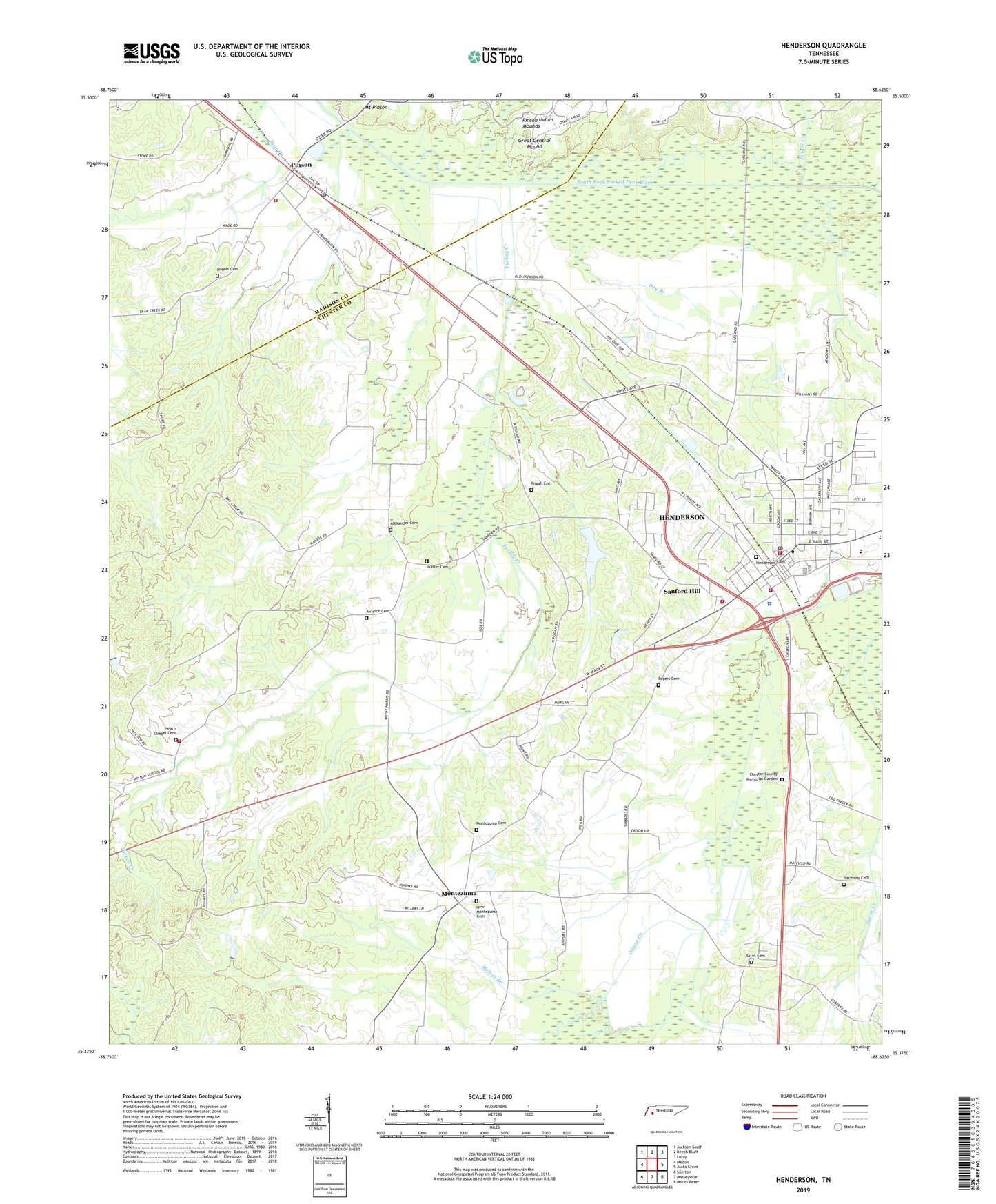
2019 topographic map quadrangle Henderson in the state of Tennessee. Scale: 1:24000. Based on the newly updated USGS 7.5' US Topo map series, this map is in the following counties: Chester, Madison. The map contains contour data, water features, and other items you are used to seeing on USGS maps, but also has updated roads and other features. This is the next generation of topographic maps. Printed on high-quality waterproof paper with UV fade-resistant inks.
Quads adjacent to this one:
West: Medon
Northwest: Jackson South
North: Beech Bluff
Northeast: Luray
East: Jacks Creek
Southeast: Mount Peter
South: Masseyville
Southwest: Silerton
Contains the following named places: Alexander Cemetery, Antioch Baptist Church, Antioch Cemetery, Balls Store, Chester County Courthouse, Chester County Fire Department / Hearn Chapel Volunteer Fire Department Station 530, Chester County Fire Department Headquarters, Chester County High School, Chester County Memorial Garden, Chester County Sheriff's Office, Chester County Training School, Cisco Indian Village, City of Henderson, Commissioner District 4, Commissioner District 6, Cool Springs Baptist Church, Dry Branch, Dry Creek, Estes Cemetery, Estes Church, Finger Creek, First Pentecostal Church, First United Methodist Church, Freed - Hardeman University, Great Central Mound, Harmony Cemetery, Harmony Church, Hearn Chapel Cemetery, Henderson, Henderson Cemetery, Henderson Church of Christ, Henderson City Hall, Henderson Clinic, Henderson Fire Department Station 1, Henderson Fire Department Station 2, Henderson First Baptist Church, Henderson Industrial Park, Henderson Police Department, Henderson Post Office, Hudson Branch, Hunter Cemetery, Jackson Clinic of Henderson, Jones Creek, Madison County Fire Department Station 13, Magic Valley Industrial Park, Melton Branch, Montezuma, Montezuma Cemetery, Montezuma School, Mount Pinson, Mount Pleasant Church, New Montezuma Cemetery, North Chester County Elementary School, Parkers Store, Pinson, Pinson Baptist Church, Pinson Census Designated Place, Pinson Elementary School, Pinson Indian Mounds, Pinson Mounds State Archaeological Area, Pinson Post Office, Pisgah Cemetery, Pisgah Church, Pleasant Ridge Church, Rogers Cemetery, Rogers School, Sanford Hill, Sanford Hill Baptist Church, Turk Creek, Turkey Creek, Webb Branch, West Chester County Elementary School, West Chester Division, WFHC-FM (Henderson), WHHM-AM (Henderson), Wilson School, ZIP Codes: 38340, 38366