MyTopo
Luray Tennessee US Topo Map
Couldn't load pickup availability
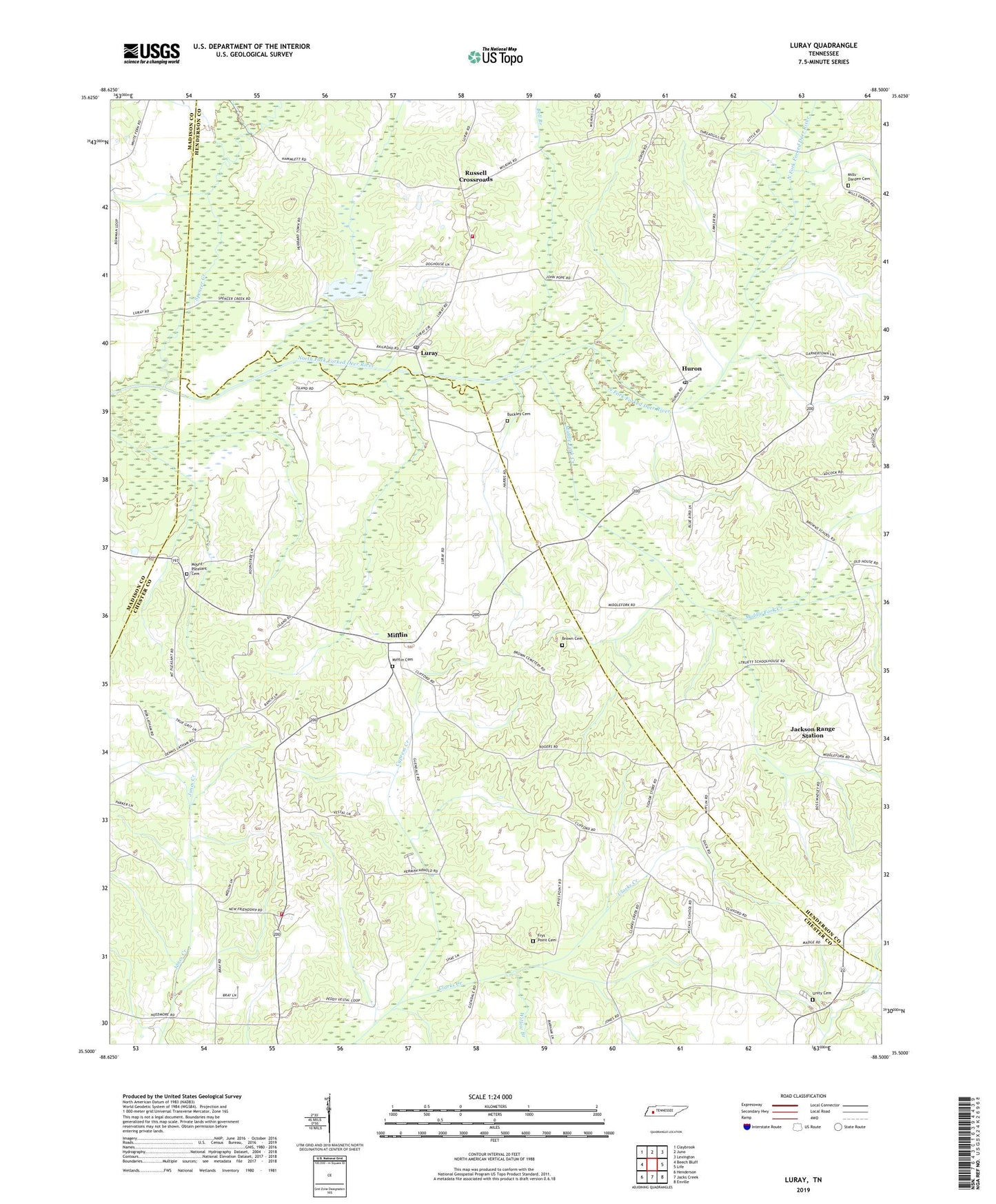
2022 topographic map quadrangle Luray in the state of Tennessee. Scale: 1:24000. Based on the newly updated USGS 7.5' US Topo map series, this map is in the following counties: Chester, Henderson, Madison. The map contains contour data, water features, and other items you are used to seeing on USGS maps, but also has updated roads and other features. This is the next generation of topographic maps. Printed on high-quality waterproof paper with UV fade-resistant inks.
Quads adjacent to this one:
West: Beech Bluff
Northwest: Claybrook
North: Juno
Northeast: Lexington
East: Life
Southeast: Enville
South: Jacks Creek
Southwest: Henderson
This map covers the same area as the classic USGS quad with code o35088e5.
Contains the following named places: Bell Branch, Bells Mill, Braye School, Brown Cemetery, Brown Church, Brown School, Browns School, Buckley Cemetery, Cawthon School, Chester County Fire Department / Hill Top Volunteer Fire Department Station 520, Clarks Creek School, Commissioner District 2, Cypress Creek, Evans Mill, Friendship Baptist Church, Frys Point Cemetery, Frys Point Church, Henderson County Fire Department Station 11, Huron, Huron Baptist Church, Huron Census Designated Place, Huron Post Office, Jackson Range Station, Jones Creek 101-102-0 Dam, Jones Creek Lake, Joyners Grove School, Luray, Luray Census Designated Place, Luray Division, Luray Post Office, Luray School, McCalls School, Middle Fork Church, Middle Fork Creek, Mifflin, Mifflin Cemetery, Mifflin Memorial Park, Mifflin Missionary Baptist Church, Mifflin School, Mills-Darden Cemetery, Mount Pleasant Cemetery, Mount Pleasant Church, New Friendship, New Friendship School, Ollies Grove School, Robert Williams Dam, Robert Williams Lake, Russell Crossroads, Russells Cross Roads School, Spencer Creek, Union Grove Church, Unity Cemetery, Unity Church, Willow Branch, ZIP Codes: 38313, 38345, 38352