MyTopo
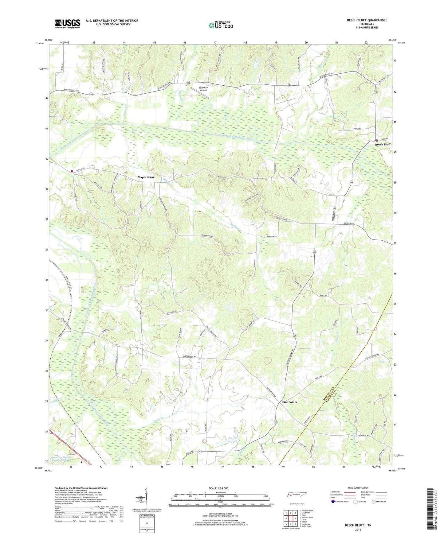
Beech Bluff Tennessee US Topo Map
Couldn't load pickup availability
2022 topographic map quadrangle Beech Bluff in the state of Tennessee. Scale: 1:24000. Based on the newly updated USGS 7.5' US Topo map series, this map is in the following counties: Madison, Chester. The map contains contour data, water features, and other items you are used to seeing on USGS maps, but also has updated roads and other features. This is the next generation of topographic maps. Printed on high-quality waterproof paper with UV fade-resistant inks.
Quads adjacent to this one:
West: Jackson South
Northwest: Jackson North
North: Claybrook
Northeast: Juno
East: Luray
Southeast: Jacks Creek
South: Henderson
Southwest: Medon
This map covers the same area as the classic USGS quad with code o35088e6.
Contains the following named places: Antioch Church, Bear Creek, Beech Bluff, Beech Bluff Census Designated Place, Beech Bluff Church, Beech Bluff Elementary School, Beech Bluff Post Office, Beech Bluff School, Big Springs Church, Brown Creek, Commissioner District 8, County Line School, Diamond Grove Church, Five Points, Harris Creek, Hunters Creek, Hurts Chapel Christian Methodist Episcopal Church, Hurts School, Isaac Chapel, Laurel Church, Madison County Fire Department Station 15, Madison County Fire Department Station 4, Maple Grove, Marlin Creek, Mason Wells Church, Moore Branch, Moore School, Pleasant Hill Church, Potts Chapel, Rocky Springs Church, Southfork Airport, Zion Hill Church