MyTopo
Smithville Tennessee US Topo Map
Couldn't load pickup availability
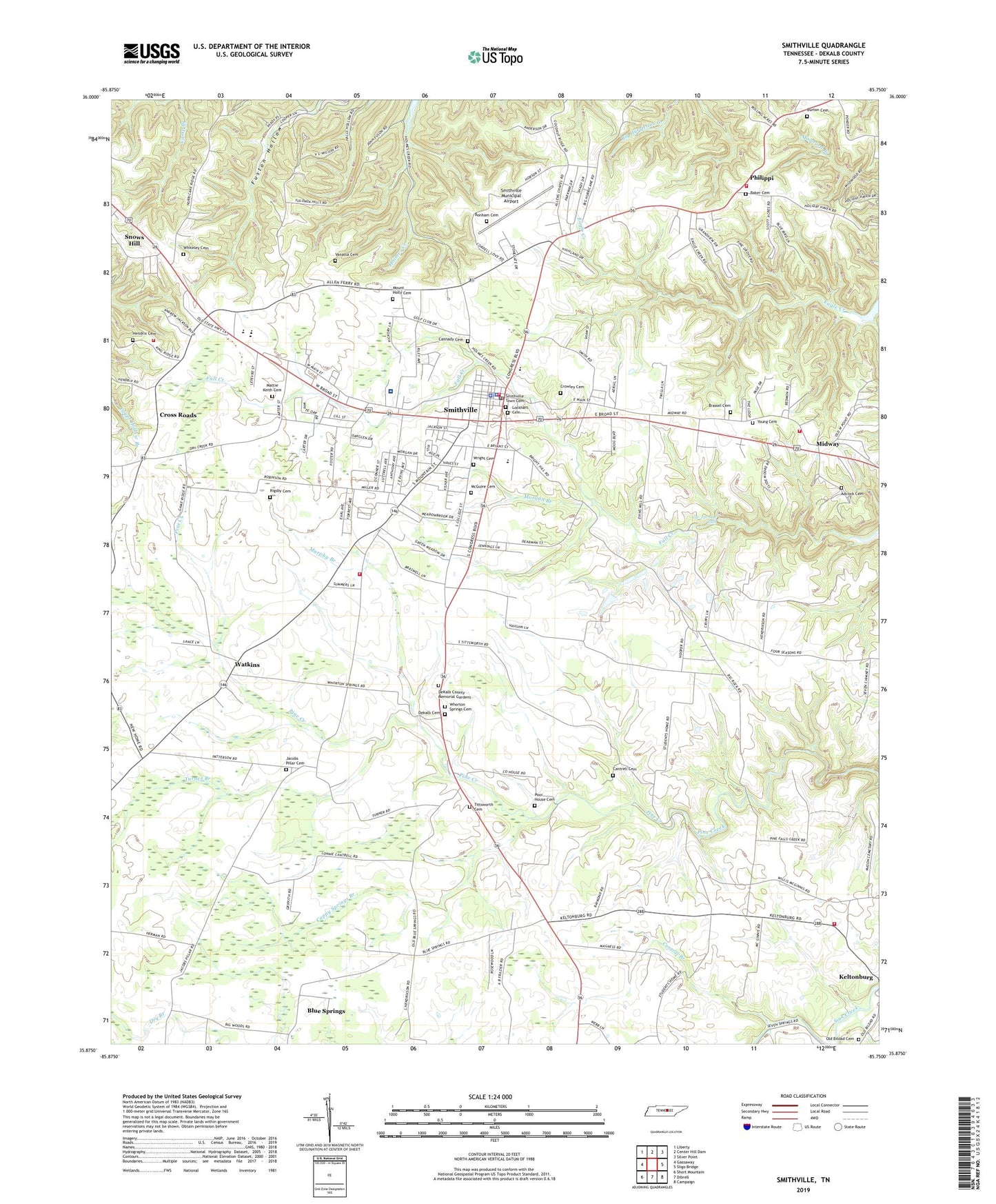
2022 topographic map quadrangle Smithville in the state of Tennessee. Scale: 1:24000. Based on the newly updated USGS 7.5' US Topo map series, this map is in the following counties: DeKalb. The map contains contour data, water features, and other items you are used to seeing on USGS maps, but also has updated roads and other features. This is the next generation of topographic maps. Printed on high-quality waterproof paper with UV fade-resistant inks.
Quads adjacent to this one:
West: Gassaway
Northwest: Liberty
North: Center Hill Dam
Northeast: Silver Point
East: Sligo Bridge
Southeast: Campaign
South: Dibrell
Southwest: Short Mountain
This map covers the same area as the classic USGS quad with code o35085h7.
Contains the following named places: Adcock Cemetery, Allens Chapel, Allens Chapel School, Baker Cemetery, Blue Springs, Bonham Cemetery, Brassel Cemetery, Bright Hill Church, Burton Cemetery, Calvary Baptist Church, Cannady Cemetery, Cantrell Cemetery, Cappy Springs Branch, Central Branch, City of Smithville, Colverts Lake, Colverts Lake Dam, Commissioner District 3, Commissioner District 7, Cross Roads, Cross Roads School, Crowley Cemetery, Cul-car-mac Falls, Dekalb Cemetery, DeKalb Community Hospital, DeKalb County, DeKalb County Courthouse, DeKalb County Emergency Medical Services, Dekalb County Fire Department Station 59 Main, Dekalb County Fire Department Station 61 Cookeville Highway, Dekalb County Fire Department Station 62 Short Mountain, Dekalb County Fire Department Station 63, Dekalb County Fire Department Station 64, DeKalb County High School, DeKalb County Memorial Gardens, DeKalb County Sheriff's Department, District 5, District 9, Doctors Hospital, Elizabeth Chapel Missionary Baptist Church, Evins Mill Pond, First Baptist Church, First United Pentecostal Church, Hendrix Cemetery, Indian Creek Memorial Baptist Church, Jacobs Pillar Cemetery, Jacobs Pillar Church, Joe L Evins Park, Lockhart Cemetery, Magness Mills, Martins Chapel, Mattie Keith Cemetery, McGuire Cemetery, Midway, Midway School, Morgan Branch, Mount Hermon Missionary Baptist Church, Mount Holly Cemetery, Mount Sterling, Murphy Branch, New Home Missionary Baptist Church, New West Point Freewill Baptist Church, Northside Church, Old Bildad Baptist Church, Old Bildad Cemetery, Philippi, Phillipi Church of Christ, Pomeroy Church, Poor House Cemetery, Rigsby Cemetery, Shining Rock, Smithville, Smithville Cumberland Presbyterian Church, Smithville Division, Smithville Fire Department, Smithville Municipal Airport, Smithville Police Department, Smithville Post Office, Smithville School, Smithville Town Cemetery, Smithville United Methodist Church, Tittsworth Cemetery, Turner Branch, Vanatta Cemetery, Watkins, Watkins School, Wells Mill, West Gate Shopping Center, Whiteley Cemetery, Whorton Springs Cemetery, Whorton Springs Church, WJLE-AM (Smithville), WJLE-FM (Smithville), Wright Cemetery, Young Cemetery, ZIP Code: 37166