MyTopo
Stanton Tennessee US Topo Map
Couldn't load pickup availability
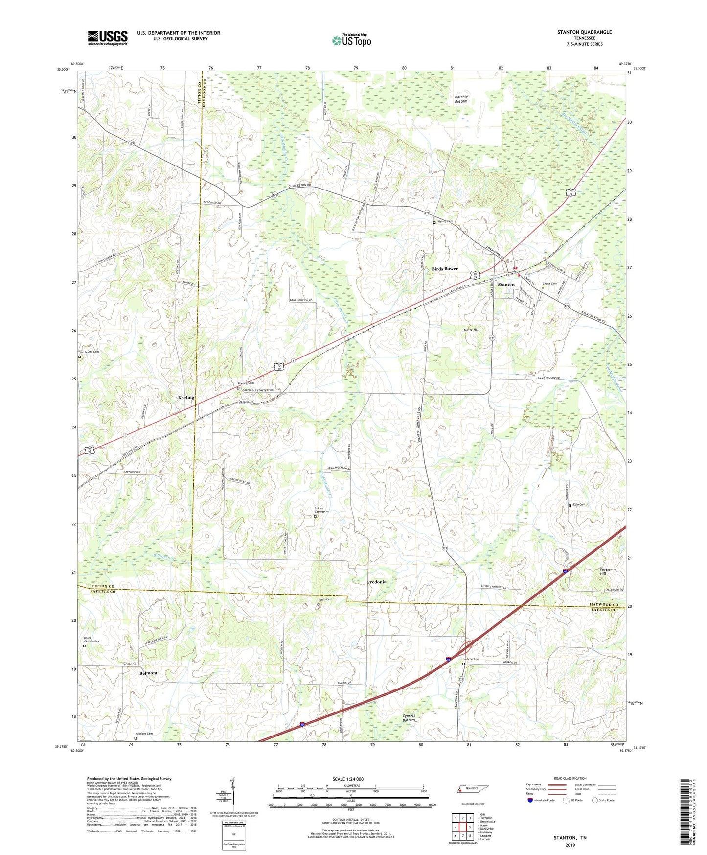
2019 topographic map quadrangle Stanton in the state of Tennessee. Scale: 1:24000. Based on the newly updated USGS 7.5' US Topo map series, this map is in the following counties: Haywood, Fayette, Tipton. The map contains contour data, water features, and other items you are used to seeing on USGS maps, but also has updated roads and other features. This is the next generation of topographic maps. Printed on high-quality waterproof paper with UV fade-resistant inks.
Quads adjacent to this one:
West: Mason
Northwest: Gift
North: Turnpike
Northeast: Brownsville
East: Dancyville
Southeast: Laconia
South: Lambert
Southwest: Gallaway
Contains the following named places: Belmont, Belmont Cemetery, Belmont Church, Bethlehem Church, Birds Bower, Bland Cemeteries, Brownsville - Haywood County Fire Department District 4, Chote Cemetery, Cole Cemetery, Collier Cemeteries, Fortescue Hill, Fredonia, Fredonia Church, Fredonia School, Gailor, Gailor High School, Green Leaf Cemetery, Green Leaf Church, Green School, Hebron Cemetery, Hebron Church, Hicks School, Jones Cemetery, Keeling, Keeling School, Meux Corner, Meux Hill, Midway School, Scrub Oak Cemetery, Stanton, Stanton Fire Department, Stanton Post Office, Stanton School, Town of Stanton, Wesley Cemetery