MyTopo
Westmoreland Tennessee US Topo Map
Couldn't load pickup availability
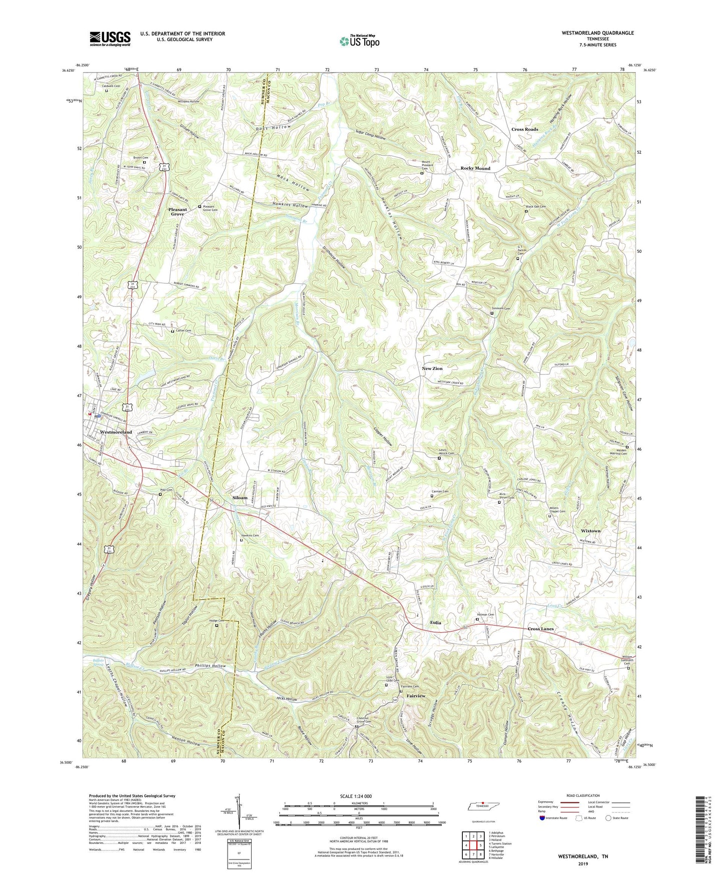
2019 topographic map quadrangle Westmoreland in the state of Tennessee. Scale: 1:24000. Based on the newly updated USGS 7.5' US Topo map series, this map is in the following counties: Macon, Sumner. The map contains contour data, water features, and other items you are used to seeing on USGS maps, but also has updated roads and other features. This is the next generation of topographic maps. Printed on high-quality waterproof paper with UV fade-resistant inks.
Quads adjacent to this one:
West: Turners Station
Northwest: Adolphus
North: Petroleum
Northeast: Holland
East: Lafayette
Southeast: Hillsdale
South: Hartsville
Southwest: Bethpage
Contains the following named places: Black Oak Cemetery, Brown Cemetery, Buffalo Spring, Caldwell Cemetery, Carman Cemetery, Carter Cemetery, Chestnut Grove Cemetery, Clines School, Coleman Hollow, Commissioner District 11, Commissioner District 20, Commissioner District 5, Commissioner District 6, Copper Hollow, Cross Lanes, Cross Roads, Cross Roads School, Davis Branch, Doss Hollow, Eulia, Eulia Church, Fairview, Fairview Cemetery, G T Dalton Cemetery, Garrett Creek Church, Gilliam Hollow, Hawkins Cemetery, Hawkins Hollow, Henson Hollow, Hicks Hollow, Hodge Cemetery, Holman Cemetery, Hoskins Hollow, Janey Branch, Leaths Branch, Leaths Chapel, Leaths Chapel Hollow, Leaths Chapel School, Leaths Hollow, Lewis Minick Cemetery, Love - Ladd Cemetery, Mack Hollow, Millers Chapel, Millers Chapel Cemetery, Morrison Branch, Mount Pleasant Church of Christ Cemetery, New Liberty Church, New Zion, Pearson Hollow, Pike Cemetery, Pisgah Church, Pleasant Grove, Pleasant Grove Baptist Church, Pleasant Grove Cemetery, Pleasant Grove School, Pop Branch, Rocky Mound, Rocky Mound Baptist Church, Rouse Hollow, Saltpeter Cave Hollow, Shrum Cemetery, Siloam, Siloam Baptist Church, Siloam Census Designated Place, Siloam Division, Simmons Branch, Simmons Cemetery, Sloan Hollow, Stillhouse Hollow, Sugar Camp Hollow, Taylor Hollow, Tooley Branch, Town of Westmoreland, Union Hill Church, Walden - Walrond Cemetery, Westmoreland, Westmoreland Civil Defense and Volunteer Fire Department, Westmoreland First Baptist Church, Westmoreland Police Department, Westmoreland Post Office, Westside Elementary School, William Galbraith Cemetery, Williams Hollow, Wix Branch, Wixtown, ZIP Code: 37186