
MyTopo
Westover Tennessee US Topo Map
Couldn't load pickup availability
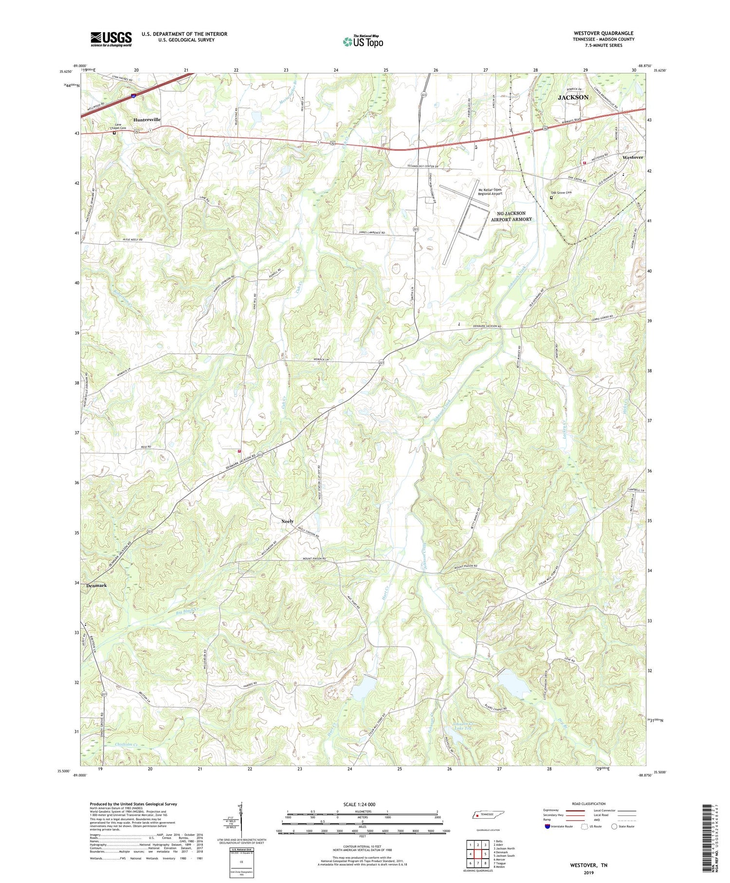
2019 topographic map quadrangle Westover in the state of Tennessee. Scale: 1:24000. Based on the newly updated USGS 7.5' US Topo map series, this map is in the following counties: Madison. The map contains contour data, water features, and other items you are used to seeing on USGS maps, but also has updated roads and other features. This is the next generation of topographic maps. Printed on high-quality waterproof paper with UV fade-resistant inks.
Quads adjacent to this one:
West: Denmark
Northwest: Bells
North: Adair
Northeast: Jackson North
East: Jackson South
Southeast: Medon
South: Teague
Southwest: Mercer
Contains the following named places: Andrews Chapel, Ararat Church, Blairs Chapel, Blairs School, Burkitt Siding, Camp Bonson, Cerro Gardo Church, Commissioner District 7, Denmark Elementary School, Dry Branch, Golden School, Hart Creek, Huntersville, Huntersville Division, Huntersville School, Johnson Creek Dam Four, Johnson Creek Dam Seven, Johnson Creek Dam Ten, Johnson Creek Lake Four, Johnson Creek Lake Seven, Johnson Creek Lake Ten, Lackey Creek, Lane Chapel, Lane Chapel Cemetery, Little Johnson Creek, Madison County Fire Department Station 16, Madison County Fire Department Station 5, Madison County Home, McKellar-Sipes Regional Airport, Mount Olive Church, Neely, Neely School, Oak Grove, Oak Grove Cemetery, Oak Grove Church, Oak Grove School, Pope Park, Upper Ingram School, West High School, Westover, Westover Baptist Church, Westover School, ZIP Code: 38391


