MyTopo
Adair Tennessee US Topo Map
Couldn't load pickup availability
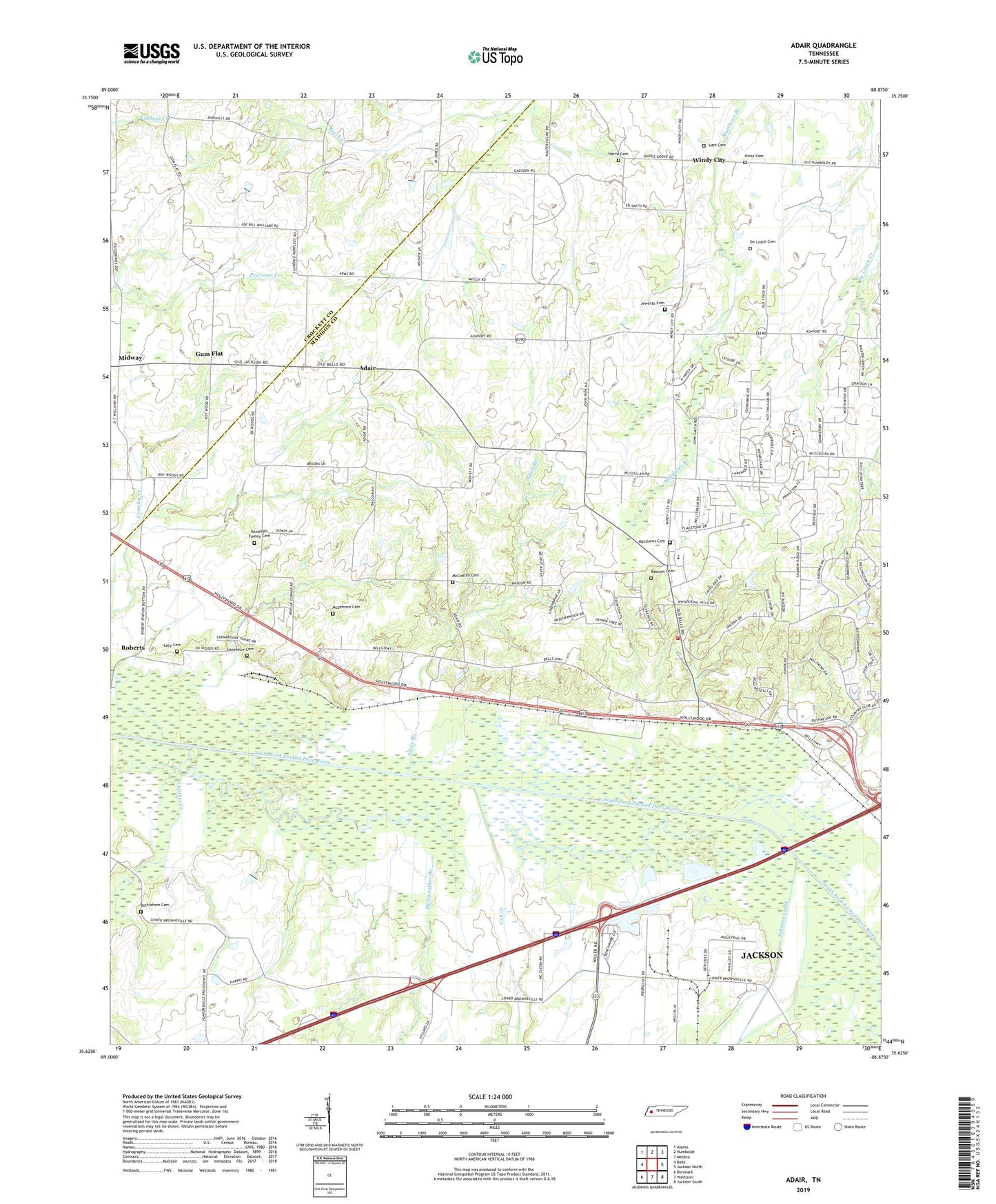
2022 topographic map quadrangle Adair in the state of Tennessee. Scale: 1:24000. Based on the newly updated USGS 7.5' US Topo map series, this map is in the following counties: Madison, Crockett. The map contains contour data, water features, and other items you are used to seeing on USGS maps, but also has updated roads and other features. This is the next generation of topographic maps. Printed on high-quality waterproof paper with UV fade-resistant inks.
Quads adjacent to this one:
West: Bells
Northwest: Alamo
North: Humboldt
Northeast: Medina
East: Jackson North
Southeast: Jackson South
South: Westover
Southwest: Denmark
This map covers the same area as the classic USGS quad with code o35088f8.
Contains the following named places: Adair, Adair Branch, Bascom Christian Methodist Episcopal Church Cemetery, Bascom Church, Bethlehem Cemetery, Bethlehem Church, Center Point School, Commissioner District 3, Commissioner District 9, Cross Road School, Cub Creek, Cypress Creek, De Loach Cemetery, Gregory Church, Gum Flat, Harris Cemetery, Harris Grove Church, Hart Cemetery, Hicks Cemetery, Jewett Cemetery, Johnson Creek, Lacy Cemetery, Lawrence Cemetery, Madison County Fire Department Station 10, Madison West Industrial Park, Mason Grove School, Matthews Cemetery, McClellan Cemetery, McLemore Cemetery, Meriweather Branch, Midway, Midway Baptist Church, Pope Division, Poplar Corner Church, Randolph Family Cemetery, Roberts, Saint John Baptist Church, Saint Johns School, Walnut Grove Baptist Church, Walnut Grove School, Windy City, Wirt Seminary