MyTopo
Bells Tennessee US Topo Map
Couldn't load pickup availability
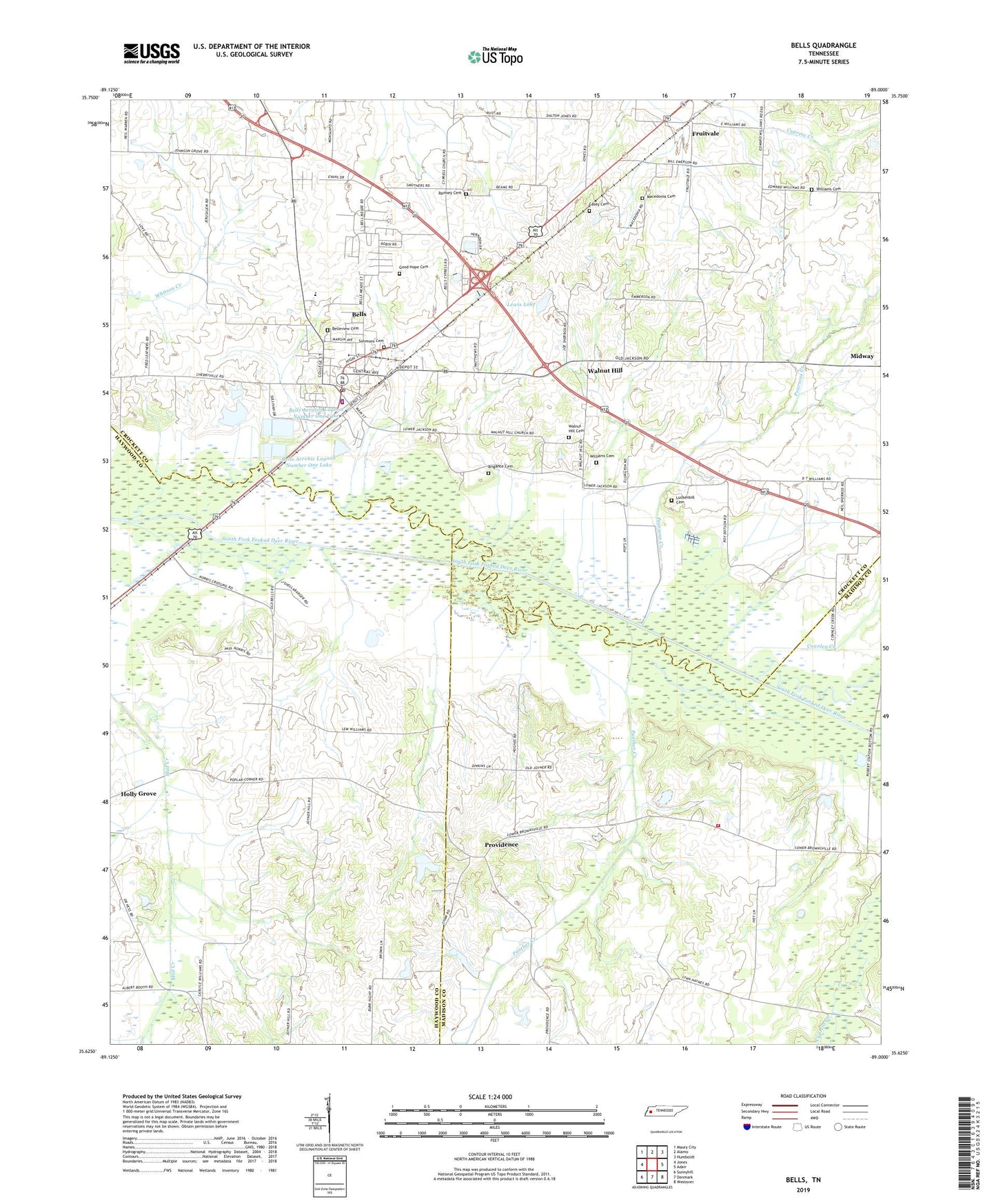
2022 topographic map quadrangle Bells in the state of Tennessee. Scale: 1:24000. Based on the newly updated USGS 7.5' US Topo map series, this map is in the following counties: Crockett, Haywood, Madison. The map contains contour data, water features, and other items you are used to seeing on USGS maps, but also has updated roads and other features. This is the next generation of topographic maps. Printed on high-quality waterproof paper with UV fade-resistant inks.
Quads adjacent to this one:
West: Jones
Northwest: Maury City
North: Alamo
Northeast: Humboldt
East: Adair
Southeast: Westover
South: Denmark
Southwest: Sunnyhill
This map covers the same area as the classic USGS quad with code o35089f1.
Contains the following named places: Belleview Cemetery, Bells, Bells Aerated Lagoon Number One Dam, Bells Aerated Lagoon Number One Lake, Bells Aerated Lagoon Number Two Dam, Bells Aerated Lagoon Number Two Lake, Bells Aerobic Lagoon Number One Dam, Bells Aerobic Lagoon Number One Lake, Bells Aerobic Lagoon Number Two Dam, Bells Aerobic Lagoon Number Two Lake, Bells Bridge, Bells Division, Bells Fire Department, Bells First Baptist Church, Bells Police Department, Bells Post Office, Bells School, Bluff Creek Church, Bluff Creek School, Brigance Cemetery, Byrd Dam, Byrd Lake, Casey Cemetery, City of Bells, Commissioner District 10, Commissioner District 11, Commissioner District 9, Connley Creek, District 1, District 5, East Haywood Church, Fruitvale, Good Hope Cemetery, Island Number Thirteen, Lewis Dam, Lewis Lake, Luckenbill Cemetery, Macedonia Cemetery, Madison County Fire Department Station 14, Morris Hill School, Panther Creek, Pearsons Creek, Poplar Corner, Providence, Ramsey Cemetery, Shellabarger Mill, Simmons Cemetery, Sunny South School, Walnut Hill, Walnut Hill Baptist Church, Walnut Hill Cemetery, Williams Cemetery, ZIP Code: 38006