
MyTopo
White City Tennessee US Topo Map
Couldn't load pickup availability
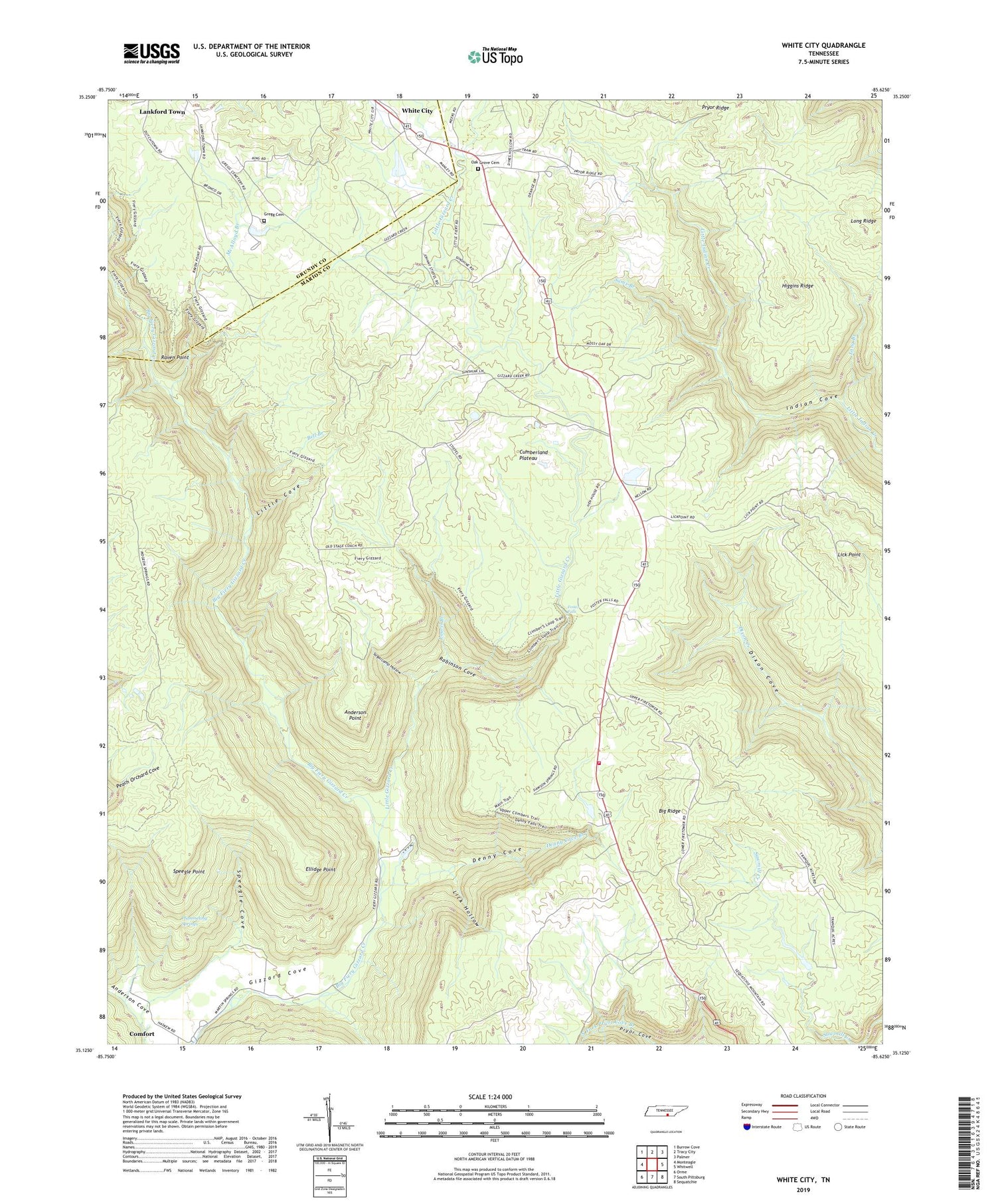
2019 topographic map quadrangle White City in the state of Tennessee. Scale: 1:24000. Based on the newly updated USGS 7.5' US Topo map series, this map is in the following counties: Marion, Grundy. The map contains contour data, water features, and other items you are used to seeing on USGS maps, but also has updated roads and other features. This is the next generation of topographic maps. Printed on high-quality waterproof paper with UV fade-resistant inks.
Quads adjacent to this one:
West: Monteagle
Northwest: Burrow Cove
North: Tracy City
Northeast: Palmer
East: Whitwell
Southeast: Sequatchie
South: South Pittsburg
Southwest: Orme
Contains the following named places: Anderson Cove, Anderson Point, Bell Branch, Big Ridge, Comfort, Commissioner District 2, Denny Cove, Denny Cove Branch, Elisons Mill, Ellidge Point, Foster Falls, Foster Falls School, Foster Falls Volunteer Fire Department, Fosters Mill, Gregg Cemetery, Haskell Foster Lake, Haskell Foster Lake Dam, Higgins Ridge, Jasper Fire Tower, Lankford Town, Laurel Branch, Lick Hollow, Little Cove, Little Gizzard Creek, Little Indian Creek, Long Branch, Long Ridge, Marshal Meeks Number 3 Mine, McAlloyd Branch, North Fork Pryor Cove Branch, Oak Grove, Oak Grove Cemetery, Pine Set School, Pineset Baptist Church, Plummeting Springs, Pryor Ridge, Pryor Ridge School, Pyburn Place, Pyror Ridge Methodist Church, Raven Point, Robinson Cove, Sams Branch, Sides Place, Speegle Cove, Speegle Point, Sugarcamp Hollow, White City, ZIP Code: 37374


