MyTopo
Woodlawn Tennessee US Topo Map
Couldn't load pickup availability
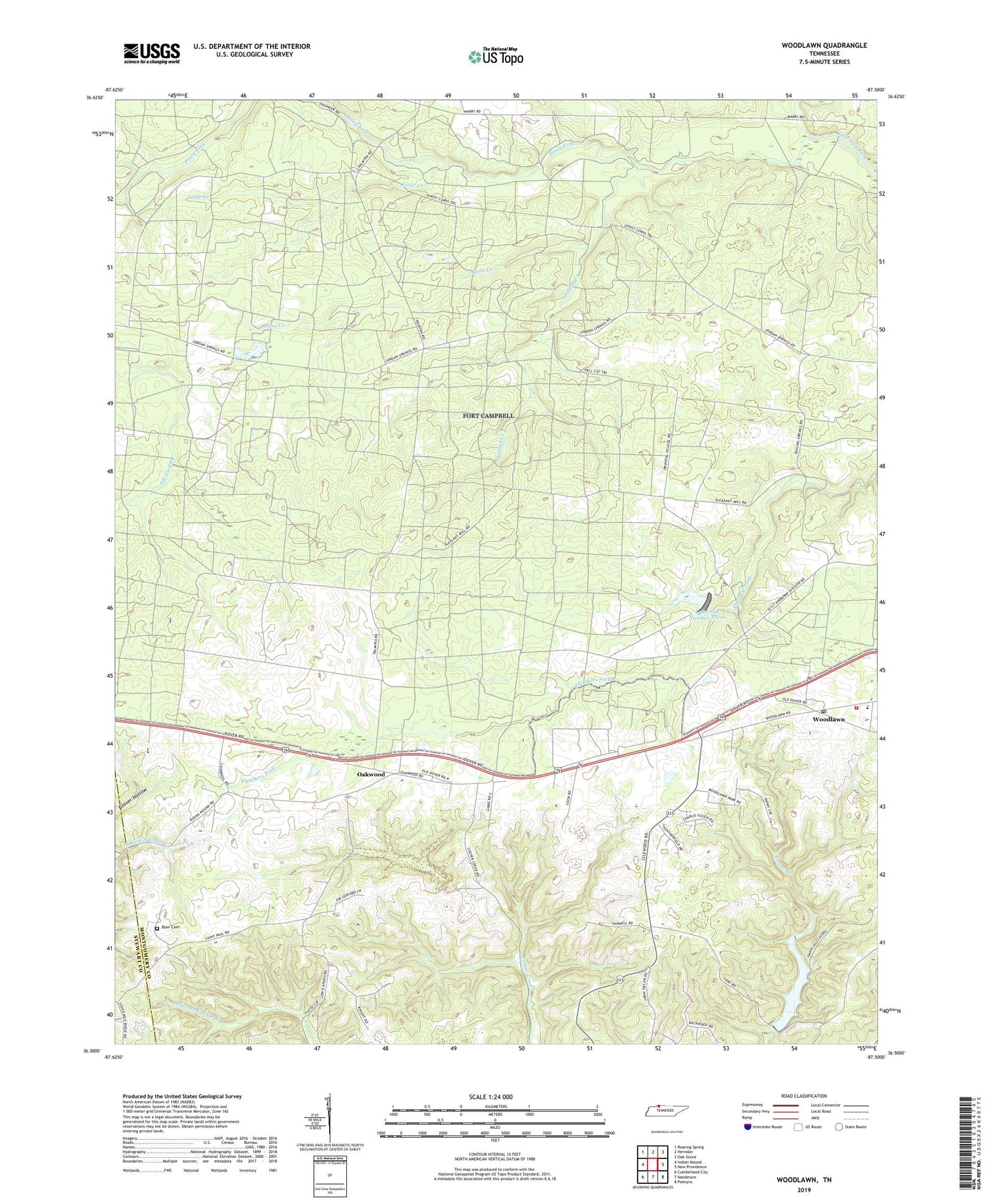
2019 topographic map quadrangle Woodlawn in the state of Tennessee. Scale: 1:24000. Based on the newly updated USGS 7.5' US Topo map series, this map is in the following counties: Montgomery, Stewart. The map contains contour data, water features, and other items you are used to seeing on USGS maps, but also has updated roads and other features. This is the next generation of topographic maps. Printed on high-quality waterproof paper with UV fade-resistant inks.
Quads adjacent to this one:
West: Indian Mound
Northwest: Roaring Spring
North: Herndon
Northeast: Oak Grove
East: New Providence
Southeast: Palmyra
South: Needmore
Southwest: Cumberland City
Contains the following named places: Blair Cemetery, Boiling Springs, Commissioner District 10, Cunningham Broadbent Lake, Cunningham Broadbent Lake Dam, District 4, Elizabeth Church, Fort Campbell, Gate Number Eleven, Gate Number Ten, Glover Hollow, Griffey Church, Griffey School, Hickory Grove Church, Hickory Grove School, Jordan Creek, Jordan Springs, Lake Site Number Three, Lake Site Number Three Dam, Little Creek, Montgomery County Landfill, Moss Creek, Oakwood, Oakwood School, Piney Fork, Pleasant Hill School, Rose Hill, Rose Hill Church, Sanctified Church, Woodlawn, Woodlawn Elementary School, Woodlawn First Baptist Church, Woodlawn Post Office, Woodlawn Volunteer Fire and Rescue, ZIP Code: 37191