MyTopo
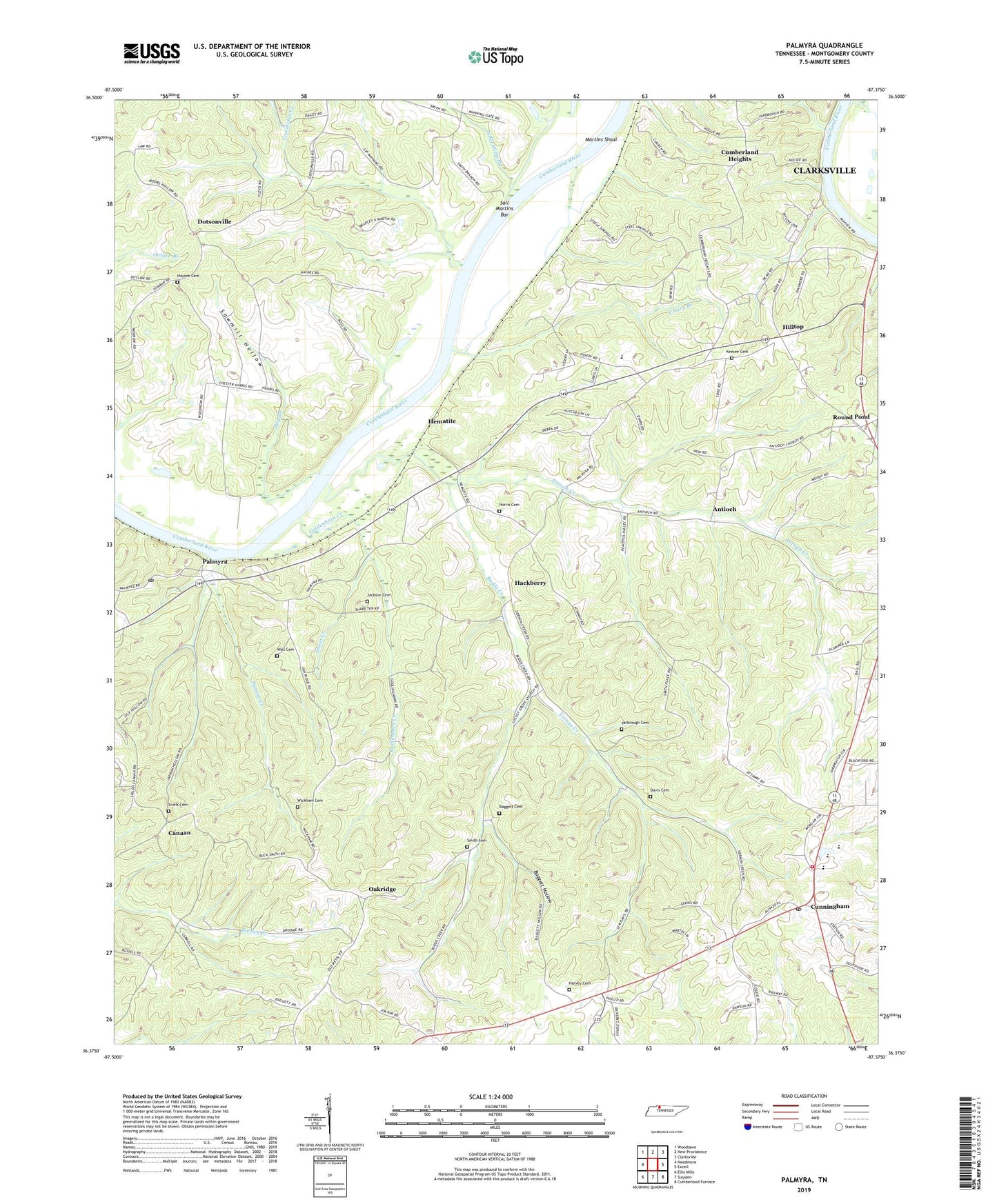
Palmyra Tennessee US Topo Map
Couldn't load pickup availability
2022 topographic map quadrangle Palmyra in the state of Tennessee. Scale: 1:24000. Based on the newly updated USGS 7.5' US Topo map series, this map is in the following counties: Montgomery. The map contains contour data, water features, and other items you are used to seeing on USGS maps, but also has updated roads and other features. This is the next generation of topographic maps. Printed on high-quality waterproof paper with UV fade-resistant inks.
Quads adjacent to this one:
West: Needmore
Northwest: Woodlawn
North: New Providence
Northeast: Clarksville
East: Excell
Southeast: Cumberland Furnace
South: Slayden
Southwest: Ellis Mills
This map covers the same area as the classic USGS quad with code o36087d4.
Contains the following named places: Acree Landing, Antioch, Antioch Creek, Antioch United Methodist Church, Baggett Cemetery, Baggett Hollow, Bryans Ore Bank, Bud Martins Landing, Budds Creek, Canaan, Canaan First Baptist Church, Central Elementary School, Central High School, Commissioner District 6, Cumberland Heights, Cumberland Heights Division, Cumberland View, Cummings Creek, Cunningham, Cunningham Post Office, Cunningham Volunteer Fire Department, Davis Cemetery, Deason Creek, District 13, District 18, District 21, Dotsonville, Dotsonville Baptist Church, Goldenhorn Creek, Hackberry, Harvey Cemetery, Haynes Cemetery, Haynes Chapel, Haynes Landing, Hematite, Hematite Recreation Area, Hilltop, Hog Branch, Hopewell Church, Immanuel Church, Jackson Cemetery, Keesee Cemetery, Locust Grove Church, Martin Chapel, Martins Shoal, Montgomery County, Montgomery Furnace, Mount Zion Baptist Church, New Canaan Church, Norris Cemetery, Oakridge, O'Neals Landing, Palmyra, Palmyra Post Office, Palmyra School, Palmyra-Shiloh Division, Phoenix Furnace, Round Pond, Sall Martins Bar, Sally Willis Branch, Sawmill Hollow, Searcys Ferry, Sivels Cemetery, Smith Branch Recreation Area, Smith Cemetery, Sweet Creek, Ussery Branch, Vernon Creek, Vernon Furnace, Wall Cemetery, Weaver Creek, Wickham Cemetery, Yarbrough Cemetery, ZIP Code: 37052


