MyTopo
Albany Texas US Topo Map
Couldn't load pickup availability
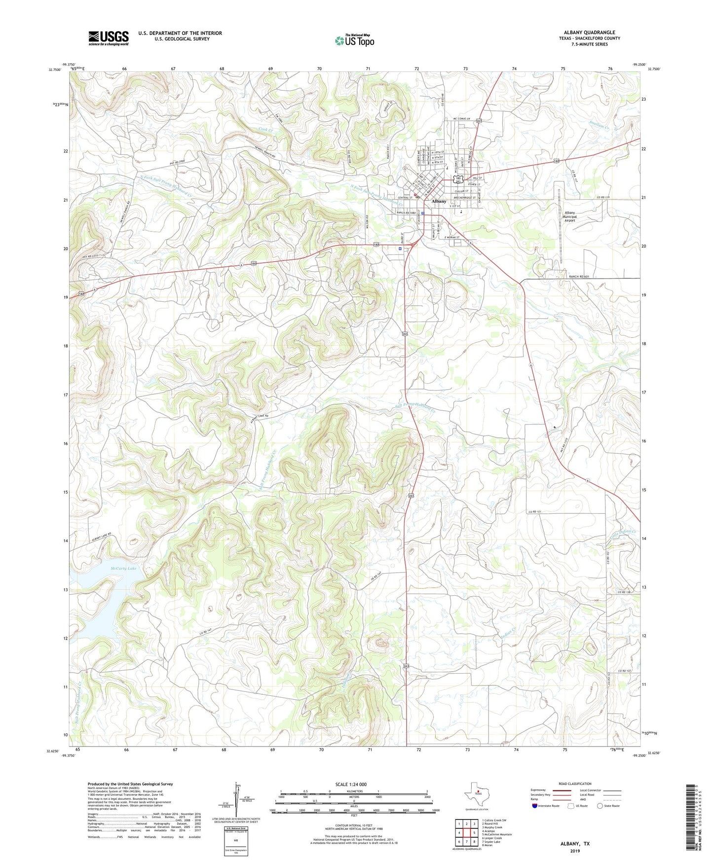
2022 topographic map quadrangle Albany in the state of Texas. Scale: 1:24000. Based on the newly updated USGS 7.5' US Topo map series, this map is in the following counties: Shackelford. The map contains contour data, water features, and other items you are used to seeing on USGS maps, but also has updated roads and other features. This is the next generation of topographic maps. Printed on high-quality waterproof paper with UV fade-resistant inks.
Quads adjacent to this one:
West: Acampo
Northwest: Collins Creek SW
North: Round Hill
Northeast: Murphy Creek
East: McCathrine Mountain
Southeast: Moran
South: Snyder Lake
Southwest: Leeper Creek
This map covers the same area as the classic USGS quad with code o32099f3.
Contains the following named places: Albany, Albany City Hall, Albany Municipal Airport, Albany Police Department, Albany Post Office, Albany Volunteer Fire Department, City of Albany, Cook Creek, First Baptist Church, McCarty Lake, McCarty Lake Dam, Nancy Smith Elementary School, North Fork Salt Prong Hubbard Creek, Presbyterian Church Nanse, Shackelford County, Shackelford County Courthouse Historic District, Shackelford County Emergency Medical Service, Shackelford County Jail, Shackelford County Sheriff's Office, Smith School, Taylor Airport, Webb Memorial Park