MyTopo
Anna Rose Texas US Topo Map
Couldn't load pickup availability
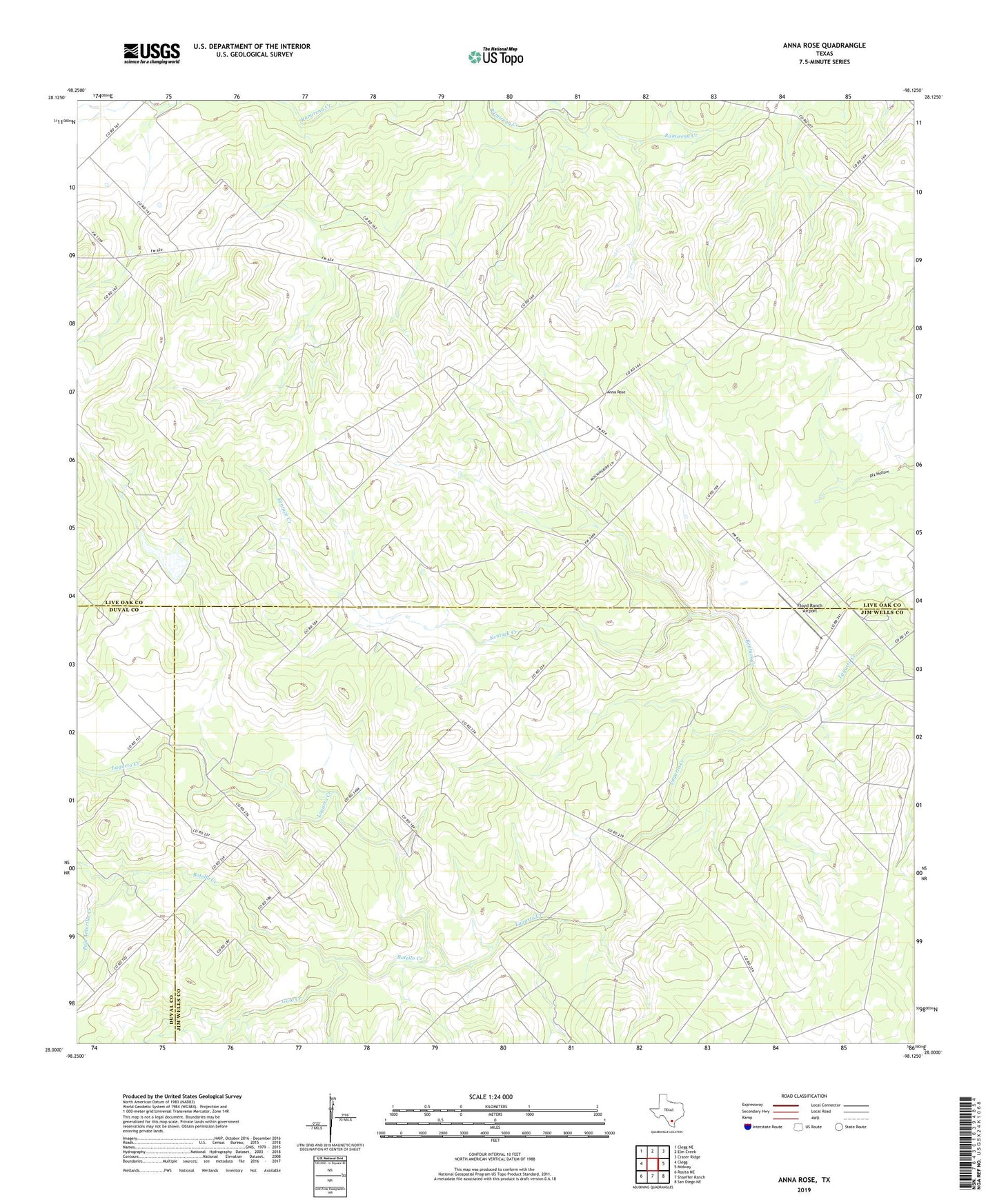
2019 topographic map quadrangle Anna Rose in the state of Texas. Scale: 1:24000. Based on the newly updated USGS 7.5' US Topo map series, this map is in the following counties: Live Oak, Jim Wells, Duval. The map contains contour data, water features, and other items you are used to seeing on USGS maps, but also has updated roads and other features. This is the next generation of topographic maps. Printed on high-quality waterproof paper with UV fade-resistant inks.
Quads adjacent to this one:
West: Clegg
Northwest: Clegg NE
North: Elm Creek
Northeast: Crater Ridge
East: Midway
Southeast: San Diego NE
South: Shaeffer Ranch
Southwest: Rosita NE
Contains the following named places: Anna Rose, Botello Creek, Calabaza Windmill, Conejo Windmill, Floyd Ranch Airport, Freeborn Ranch, Gato Creek, Kentuck Creek, La Parrita Valley Colonia, Lagarto Trib Dam, Lagarto Windmill, Laguna Windmill, Palo Amarillo Creek, Patterson Windmill, Ramirena Oil Field, Rancho de la Parita, Rancho de la Parrita, Salt Branch Ramirena Creek, Willie Tank