
MyTopo
Argyle Texas US Topo Map
Couldn't load pickup availability
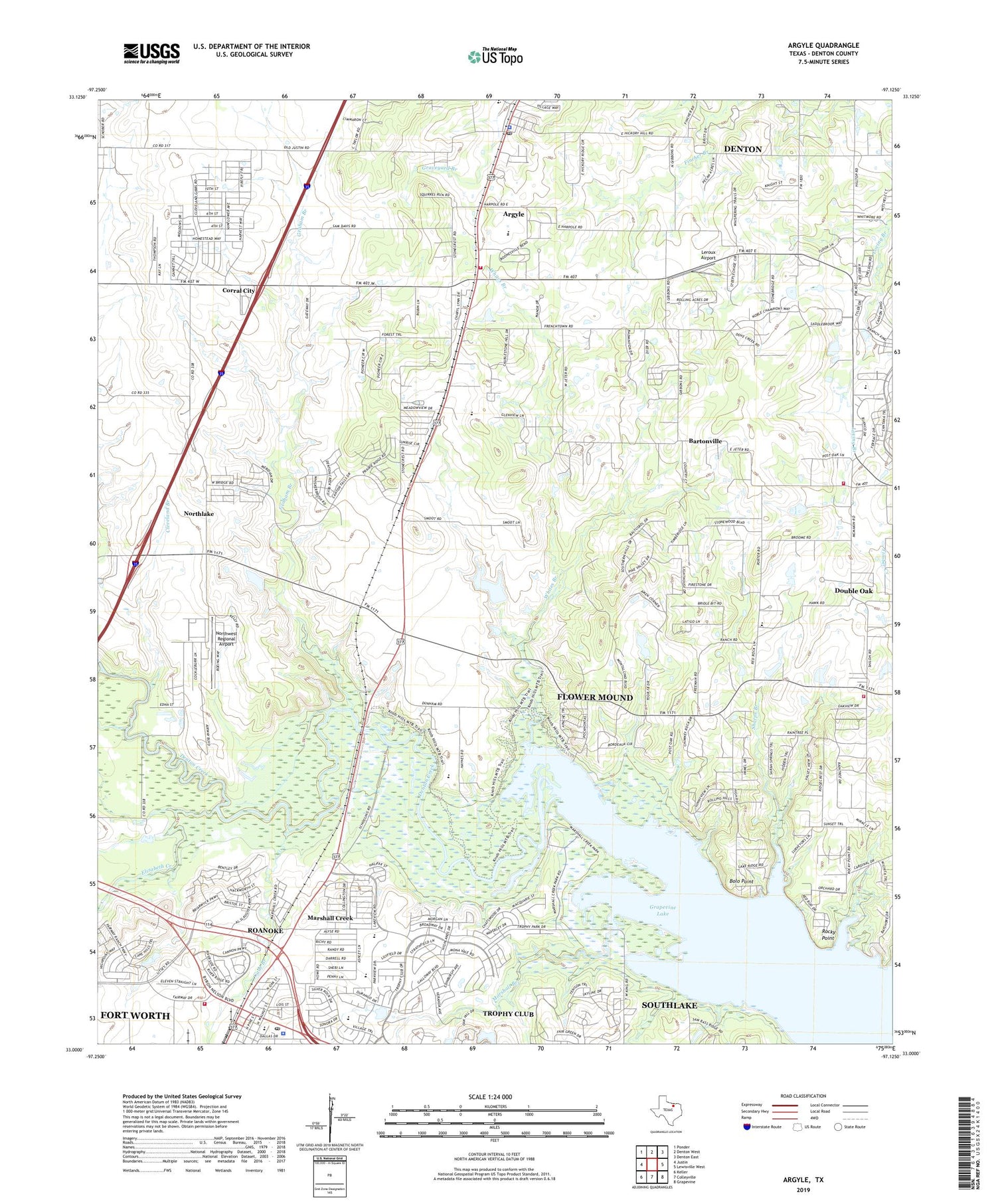
2019 topographic map quadrangle Argyle in the state of Texas. Scale: 1:24000. Based on the newly updated USGS 7.5' US Topo map series, this map is in the following counties: Denton. The map contains contour data, water features, and other items you are used to seeing on USGS maps, but also has updated roads and other features. This is the next generation of topographic maps. Printed on high-quality waterproof paper with UV fade-resistant inks.
Quads adjacent to this one:
West: Justin
Northwest: Ponder
North: Denton West
Northeast: Denton East
East: Lewisville West
Southeast: Grapevine
South: Colleyville
Southwest: Keller
Contains the following named places: Argyle, Argyle Intermediate School, Argyle Police Department, Argyle Post Office, Argyle United Methodist Church, Argyle Volunteer Fire District Station 511, Argyle Volunteer Fire District Station 512, Bartonville, Bolo Point, Burger Lake, Burger Lake Dam, Cade Branch, Catherine Branch, City of Argyle, City of Roanoke, Cleveland Branch, Corral City, Denton County Constable's Office Precinct 4, Denton Creek School, Double Oak School, Elizabeth Creek, Ewing Lake, Ewing Lake Dam, Flower Mound Fire Department Station 2, Graham Branch, Integrity Park, Knob Hills Trail, Lakeview Elementary School, Leroux Airport, Marshall Branch, Marshall Creek, Marshall Creek Park, Northwest Alliance Academy, Northwest Regional Airport, Oak Hills Community Evangelical Free Church, Prairie Mound Cemetery, Prairie Mound Church, Roanoke, Roanoke Elementary School, Roanoke Fire Department, Roanoke Police Department, Roanoke Post Office, Rocky Point, Sharps Branch, Shiloh Church, Tabernacle Baptist Church, Town of Bartonville, Town of Draper, Town of Marshall Creek, Trophy Club Golf Dam, Trophy Club Golf Lake, Whites Branch, ZIP Codes: 76226, 76262


