MyTopo
Ponder Texas US Topo Map
Couldn't load pickup availability
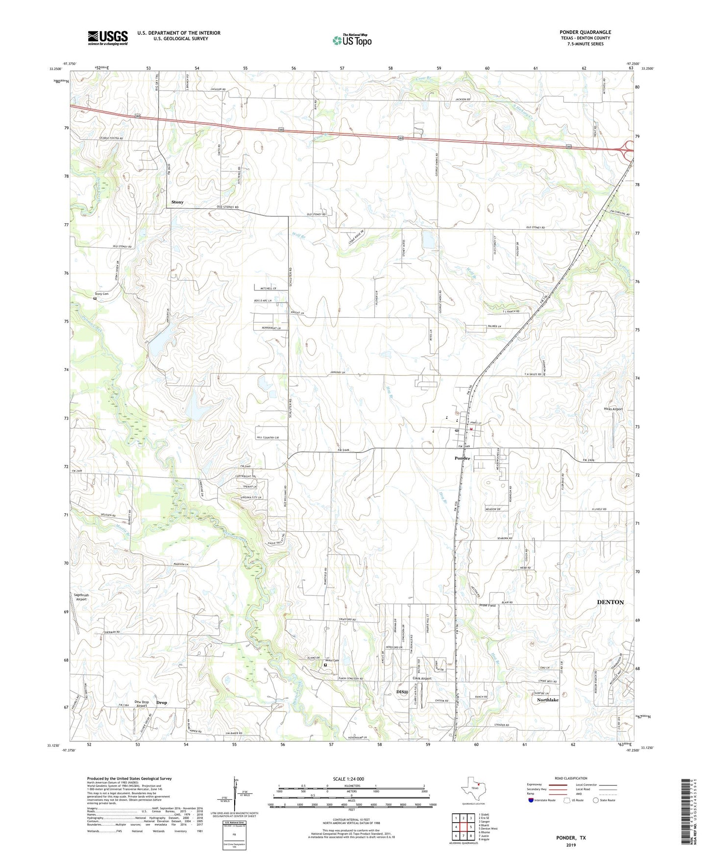
2022 topographic map quadrangle Ponder in the state of Texas. Scale: 1:24000. Based on the newly updated USGS 7.5' US Topo map series, this map is in the following counties: Denton. The map contains contour data, water features, and other items you are used to seeing on USGS maps, but also has updated roads and other features. This is the next generation of topographic maps. Printed on high-quality waterproof paper with UV fade-resistant inks.
Quads adjacent to this one:
West: Bluett
Northwest: Slidell
North: Era SE
Northeast: Sanger
East: Denton West
Southeast: Argyle
South: Justin
Southwest: Rhome
This map covers the same area as the classic USGS quad with code o33097b3.
Contains the following named places: Akain Cemetery, Brown Chapel, C Hobson Dunn Dam Number 1, C Hobson Dunn Dam Number 2, C Hobson Dunn Lake Number 1, C Hobson Dunn Lake Number 2, City of Denton Water Treatment Facility, Clark Airport, Crow Branch, Deussen Field, Dew Drop Airport, DISH, Drop, Drop Field, Dun Ranch, Flying P Airport, Hicks Airport, Morris Branch, Northlake, Palmer Field Airport, Ponder, Ponder Post Office, Ponder Volunteer Fire Department, Prose Field, Sagebrush Airport, Stony, Stony Cemetery, Town of DISH, Town of Ponder, Wolf Branch, ZIP Code: 76259