MyTopo
Asherton Texas US Topo Map
Couldn't load pickup availability
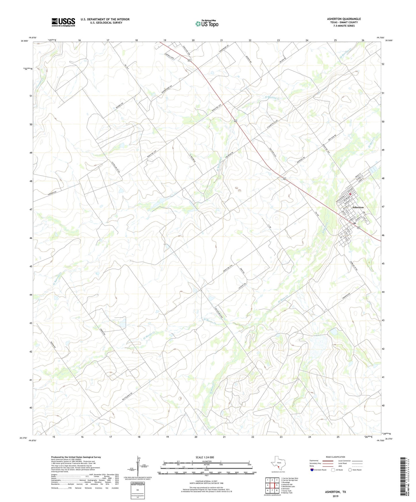
2022 topographic map quadrangle Asherton in the state of Texas. Scale: 1:24000. Based on the newly updated USGS 7.5' US Topo map series, this map is in the following counties: Dimmit. The map contains contour data, water features, and other items you are used to seeing on USGS maps, but also has updated roads and other features. This is the next generation of topographic maps. Printed on high-quality waterproof paper with UV fade-resistant inks.
Quads adjacent to this one:
West: Asherton NW
Northwest: Carrizo Springs West
North: Carrizo Springs East
Northeast: Brundage
East: MacDonald Lake
Southeast: Dabney Tank
South: Farias Tank
Southwest: Dentonio
This map covers the same area as the classic USGS quad with code o28099d7.
Contains the following named places: Asher and Mary Isabelle Richardson House, Asherton, Asherton City Hall, Asherton Post Office, Asherton Volunteer Fire Department, City of Asherton, CW Bonham, Dick Moffet, Dimmit County, DK Moffatt, Eardly Farm, El Morito Creek, Erskine Rhodes, F Gillick, F Votaw, Hardly Corp, JA oelkes, JJ Mowels, Joe White, M Rich, Marmion Lake, Marmion Lake Dam, RW Taylor, W Wallace