MyTopo
Austonio Texas US Topo Map
Couldn't load pickup availability
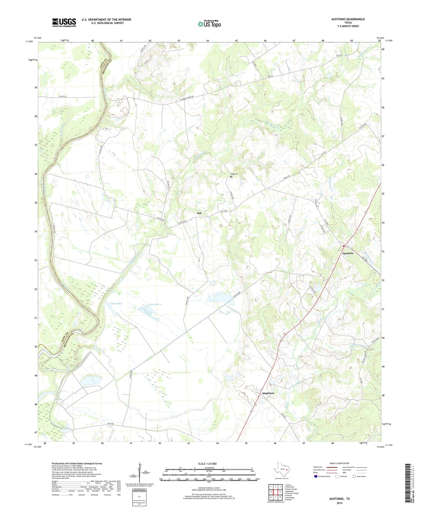
2019 topographic map quadrangle Austonio in the state of Texas. Scale: 1:24000. Based on the newly updated USGS 7.5' US Topo map series, this map is in the following counties: Houston, Leon. The map contains contour data, water features, and other items you are used to seeing on USGS maps, but also has updated roads and other features. This is the next generation of topographic maps. Printed on high-quality waterproof paper with UV fade-resistant inks.
Quads adjacent to this one:
West: Middleton
Northwest: Eunice
North: Halls Bluff
Northeast: Porter Springs
East: Pearsons Chapel
Southeast: Weldon
South: Sand Ridge
Southwest: Elwood
Contains the following named places: Alabama Ferry, Ash, Ash Church, Austin Church, Austonio, Austonio Volunteer Fire Department, Blackhouse Creek, Blue Lake Church, Bogg Cemetery, Coon Dam 1, Coon Dam 2, Coon Lake 1, Coon Lake 2, Georgia Camp Creek, Henderson Creek, Mapleton, Monticello Church, Mount Zion Church, Pecan Slough, Pleasant Grove Church, Porter Springs Division, Rattlesnake Ranch, Seven J Ramp Ranch