MyTopo
Sand Ridge Texas US Topo Map
Couldn't load pickup availability
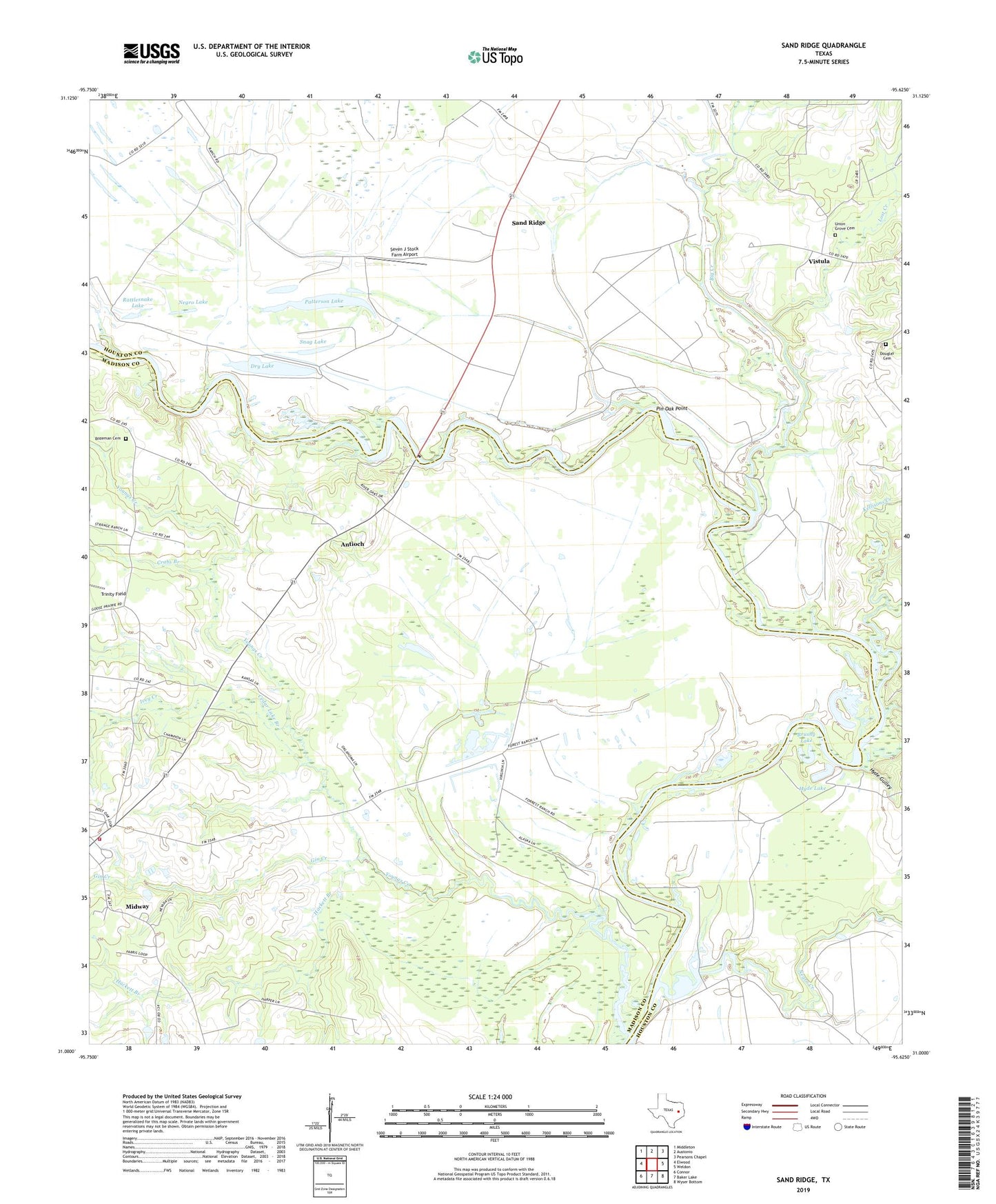
2022 topographic map quadrangle Sand Ridge in the state of Texas. Scale: 1:24000. Based on the newly updated USGS 7.5' US Topo map series, this map is in the following counties: Madison, Houston. The map contains contour data, water features, and other items you are used to seeing on USGS maps, but also has updated roads and other features. This is the next generation of topographic maps. Printed on high-quality waterproof paper with UV fade-resistant inks.
Quads adjacent to this one:
West: Elwood
Northwest: Middleton
North: Austonio
Northeast: Pearsons Chapel
East: Weldon
Southeast: Wyser Bottom
South: Baker Lake
Southwest: Connor
This map covers the same area as the classic USGS quad with code o31095a6.
Contains the following named places: Antioch, Big Creek, Bozeman Cemetery, Brushy Lake, Cedar Lake Branch, Crabs Branch, Douglas Cemetery, Dry Lake, Gin Creek, Hackett Branch, Hyde Gulley, Hyde Lake, Hydes Ferry, Ivey Creek, Kellisons Creek, Lake William Goyens, Lost Creek, Midway Division, Midway Volunteer Fire Department, Negro Creek, Patterson Lake, Pin Oak Point, Rattlesnake Lake, Sand Ridge, Seven J Stock Farm Airport, Snag Lake, Trinity Field, Union Grove Cemetery, Union Grove Church, Vistula, Vistula Church, Youngs Creek