MyTopo
Austwell Texas US Topo Map
Couldn't load pickup availability
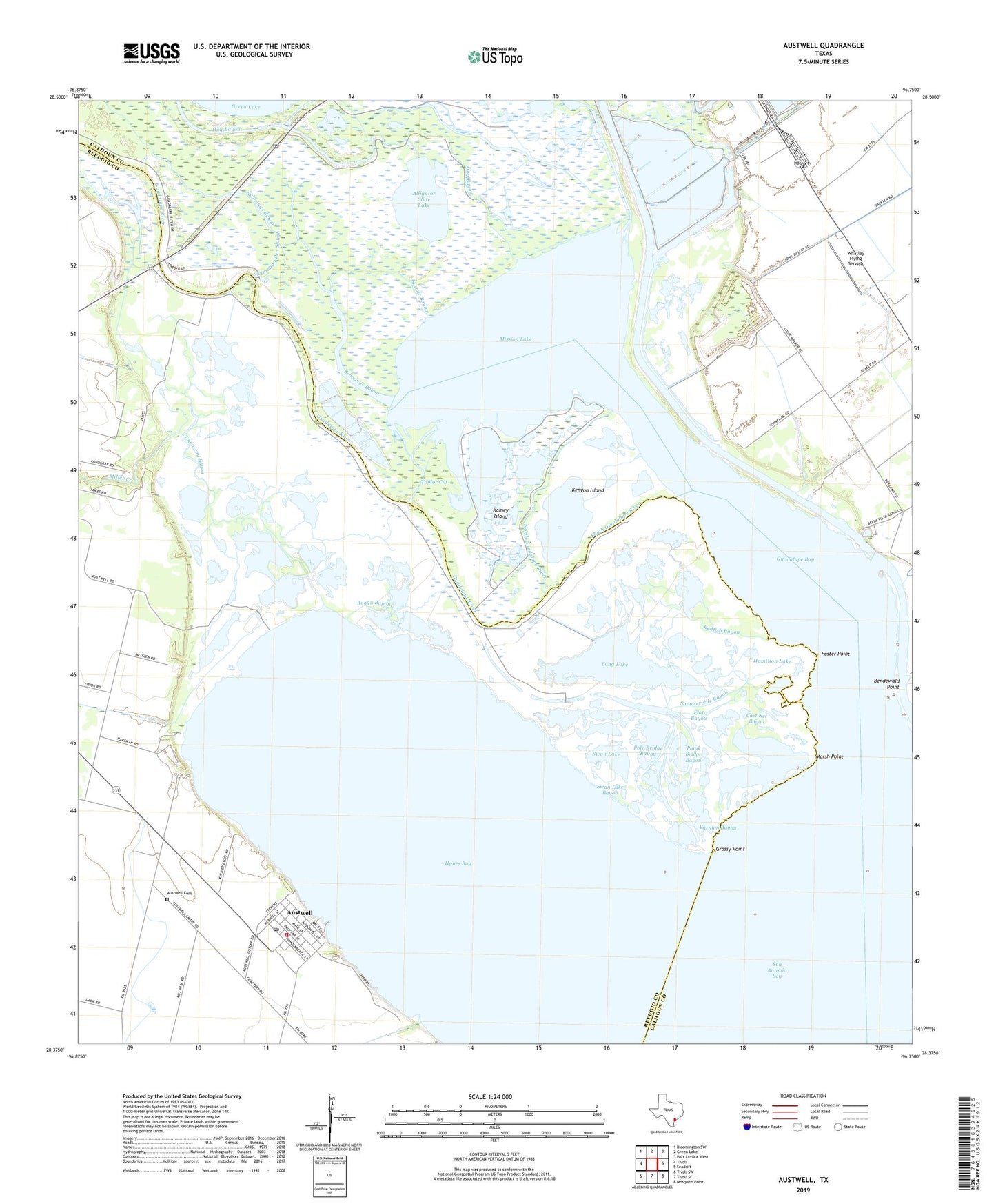
2019 topographic map quadrangle Austwell in the state of Texas. Scale: 1:24000. Based on the newly updated USGS 7.5' US Topo map series, this map is in the following counties: Refugio, Calhoun. The map contains contour data, water features, and other items you are used to seeing on USGS maps, but also has updated roads and other features. This is the next generation of topographic maps. Printed on high-quality waterproof paper with UV fade-resistant inks.
Quads adjacent to this one:
West: Tivoli
Northwest: Bloomington SW
North: Green Lake
Northeast: Port Lavaca West
East: Seadrift
Southeast: Mosquito Point
South: Tivoli SE
Southwest: Tivoli SW
Contains the following named places: Alligator Slide Lake, Austwell, Austwell Cemetery, Austwell City Hall, Austwell Post Office, Austwell Volunteer Fire Department, Bendewald Point, Big Bayou, Boggy Bayou, Cast Net Bayou, City of Austwell, Flat Bayou, Foster Point, Grassy Point, Guadalupe Bay, Guadalupe Delta Wildlife Management Area, Guadalupe River, Gulf Coast Airport, Hamilton Lake, Hog Bayou, Hynes Bay, Kamey Island, Kenyon Island, Long Lake, Long Mott, Lucas Lake, Mamie Bayou, Marsh Point, Miller Creek, Mission Lake, North Guadalupe River, Operating Basin Number 1 Levee, Plank Bridge Bayou, Pole Bridge Bayou, Redfish Bayou, Schwings Bayou, Sommerville Bayou, South Guadalupe River, Storm Harbor, Swan Lake, Swan Lake Bayou, Swimming Pen Slough, Taylor Cut, Townsend Bayou, Varnum Bayou, Whatley Flying Service