MyTopo
Tivoli SE Texas US Topo Map
Couldn't load pickup availability
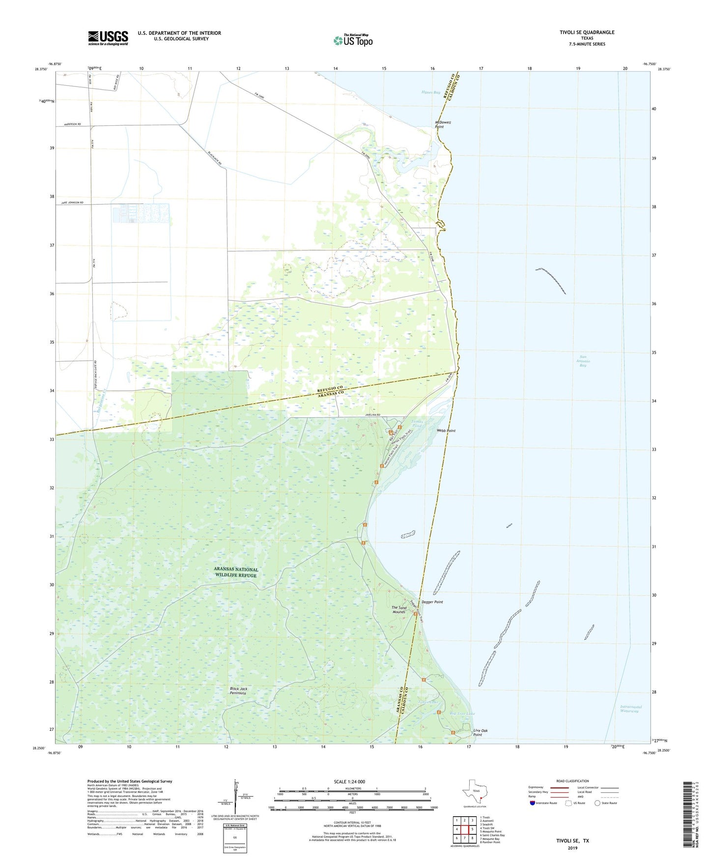
2022 topographic map quadrangle Tivoli SE in the state of Texas. Scale: 1:24000. Based on the newly updated USGS 7.5' US Topo map series, this map is in the following counties: Refugio, Calhoun, Aransas. The map contains contour data, water features, and other items you are used to seeing on USGS maps, but also has updated roads and other features. This is the next generation of topographic maps. Printed on high-quality waterproof paper with UV fade-resistant inks.
Quads adjacent to this one:
West: Tivoli SW
Northwest: Tivoli
North: Austwell
Northeast: Seadrift
East: Mosquito Point
Southeast: Panther Point
South: Mesquite Bay
Southwest: Saint Charles Bay
This map covers the same area as the classic USGS quad with code o28096c7.
Contains the following named places: Big Tree Lake, Buzzard Windmill, Dagger Point, Jones Lake, Live Oak Point, Marano Windmill, McDowell Point, Salado Windmill, Sierritos Windmill, The Sand Mounds, Tomas Pond, Tomas Windmill, Toro Windmill, Venada Windmill, Walker Windmill, Webb Point, Wild Hog Lake