MyTopo
Green Lake Texas US Topo Map
Couldn't load pickup availability
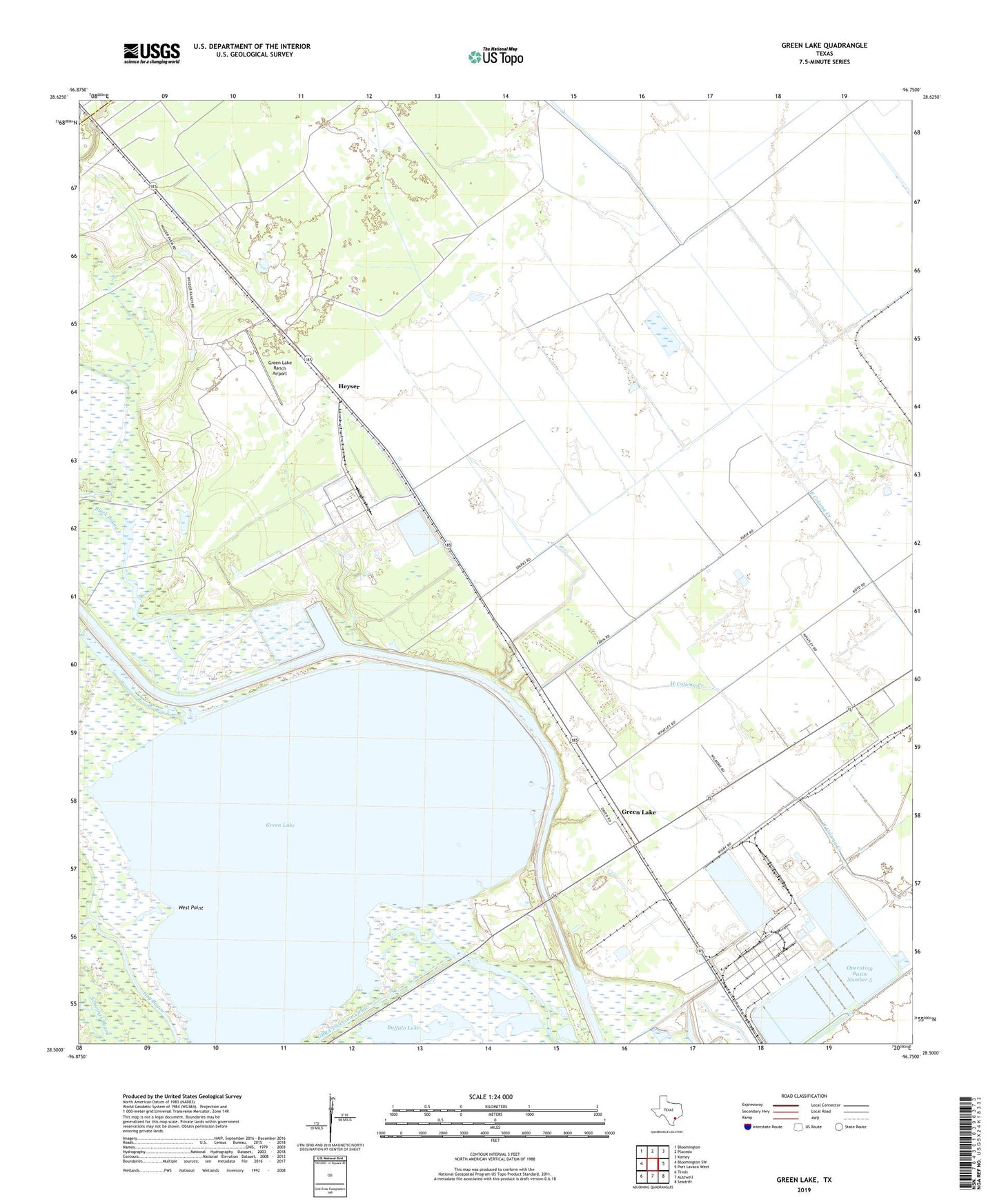
2022 topographic map quadrangle Green Lake in the state of Texas. Scale: 1:24000. Based on the newly updated USGS 7.5' US Topo map series, this map is in the following counties: Calhoun, Victoria. The map contains contour data, water features, and other items you are used to seeing on USGS maps, but also has updated roads and other features. This is the next generation of topographic maps. Printed on high-quality waterproof paper with UV fade-resistant inks.
Quads adjacent to this one:
West: Bloomington SW
Northwest: Bloomington
North: Placedo
Northeast: Kamey
East: Port Lavaca West
Southeast: Seadrift
South: Austwell
Southwest: Tivoli
This map covers the same area as the classic USGS quad with code o28096e7.
Contains the following named places: Black Bayou, Buffalo Lake, GBRA Diversion Canal, Goff Bayou, Green Lake, Green Lake Ranch Airport, Heyser, Heyser Oil Field, Jones Bayou, Kamey-Sixmile Division, North Seadrift, Operating Basin Number 1, Operating Basin Number 31, Operating Basin Number 31 Levee, Operating Basin Number 4, Operating Basin Number 4 Levee, Operating Basin Number 5, Operating Basin Number 5 Levee, Victoria Barge Canal, West Point