MyTopo
Bloomington SW Texas US Topo Map
Couldn't load pickup availability
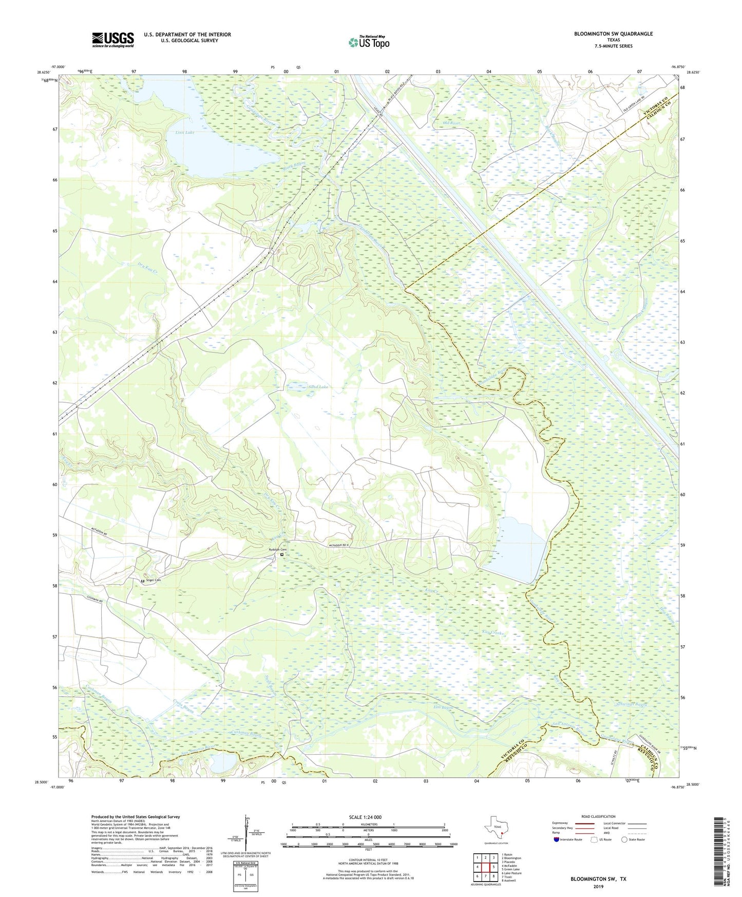
2022 topographic map quadrangle Bloomington SW in the state of Texas. Scale: 1:24000. Based on the newly updated USGS 7.5' US Topo map series, this map is in the following counties: Victoria, Calhoun, Refugio. The map contains contour data, water features, and other items you are used to seeing on USGS maps, but also has updated roads and other features. This is the next generation of topographic maps. Printed on high-quality waterproof paper with UV fade-resistant inks.
Quads adjacent to this one:
West: McFaddin
Northwest: Raisin
North: Bloomington
Northeast: Placedo
East: Green Lake
Southeast: Austwell
South: Tivoli
Southwest: Lake Pasture
This map covers the same area as the classic USGS quad with code o28096e8.
Contains the following named places: Black Bayou, Cross Bayou, Cushman Bayou, Dry Kuy Creek, Elm Bayou, Kuy Creek, Linn Lake, Old River, Rydolph Cemetery, San Antonio River, Sand Lake, Station 1888 Dam, Stiger Cemetery, Swift Bayou, ZIP Code: 77973