MyTopo
Bakers Crossing Texas US Topo Map
Couldn't load pickup availability
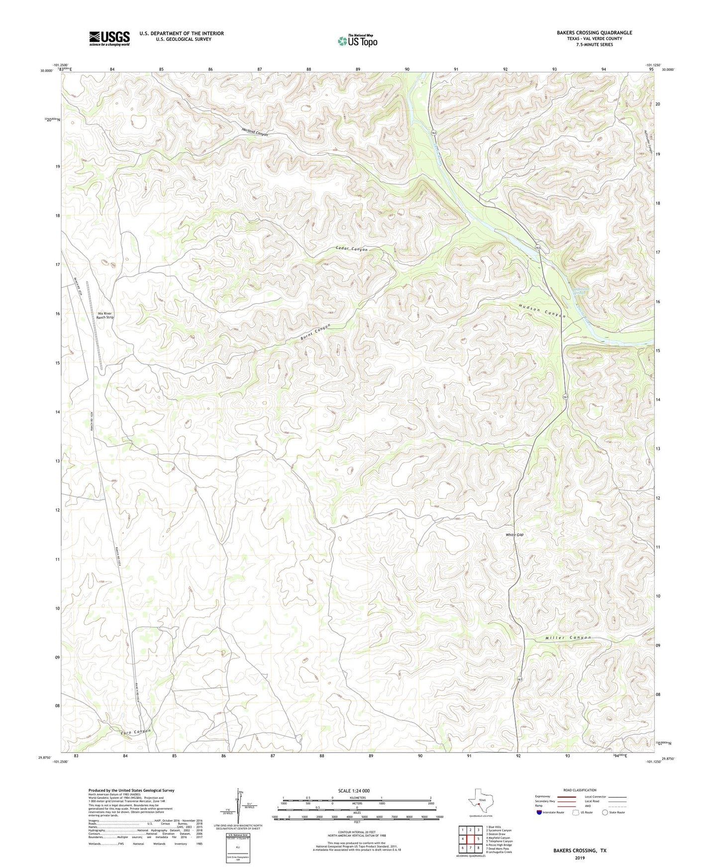
2022 topographic map quadrangle Bakers Crossing in the state of Texas. Scale: 1:24000. Based on the newly updated USGS 7.5' US Topo map series, this map is in the following counties: Val Verde. The map contains contour data, water features, and other items you are used to seeing on USGS maps, but also has updated roads and other features. This is the next generation of topographic maps. Printed on high-quality waterproof paper with UV fade-resistant inks.
Quads adjacent to this one:
West: Mayfield Canyon
Northwest: Blue Hills
North: Sycamore Canyon
Northeast: Deaton Draw
East: Telephone Canyon
Southeast: Lechuguilla Creek
South: Dead Mans Pass
Southwest: Pecos High Bridge
This map covers the same area as the classic USGS quad with code o29101h2.
Contains the following named places: Bakers Crossing, Burnt Canyon, Cedar Canyon, Harland Canyon, Hudson Canyon, Huffstutler Springs, Jarrett Ranch, Lazy Two Ranch Airport, Nix River Ranch Strip, R Prosser Ranch, S Baker Ranch, Val Verde County, W Baker Ranch, White Gap