MyTopo
Barkman Texas US Topo Map
Couldn't load pickup availability
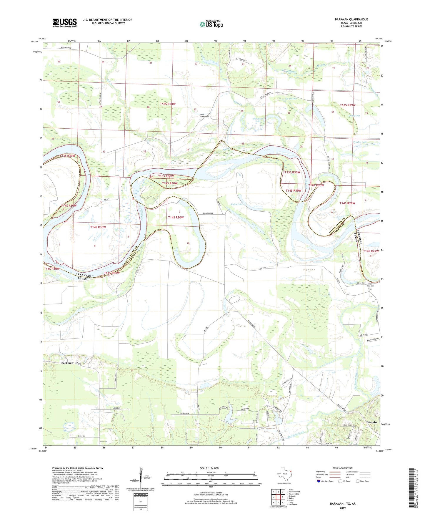
2019 topographic map quadrangle Barkman in the states of Texas, Arkansas. Scale: 1:24000. Based on the newly updated USGS 7.5' US Topo map series, this map is in the following counties: Bowie, Little River. The map contains contour data, water features, and other items you are used to seeing on USGS maps, but also has updated roads and other features. This is the next generation of topographic maps. Printed on high-quality waterproof paper with UV fade-resistant inks.
Quads adjacent to this one:
West: Redbank
Northwest: Arden
North: Ashdown West
Northeast: Ashdown East
East: Ogden
Southeast: Texarkana
South: Leary
Southwest: Hooks
Contains the following named places: Allen Creek, Barkman, Barkman Creek, Bull Creek, Clear Lake Cemetery, Everett Church, Grassy Lake, Jim Lee Lake, King Lake, Mount Zion Church, Murl Branch, Old River Lake, Pine Prairie, Red Bank, Roseborough Lake, Rush Lake, Saint Luke Baptist Church, Saint Lukes Cemetery, Scott Lake, Smith Lake, The Old Sag, Township of Red River, Trailer Lake, Walnut Bayou, Wamba, ZIP Code: 75503