MyTopo
Bastrop SW Texas US Topo Map
Couldn't load pickup availability
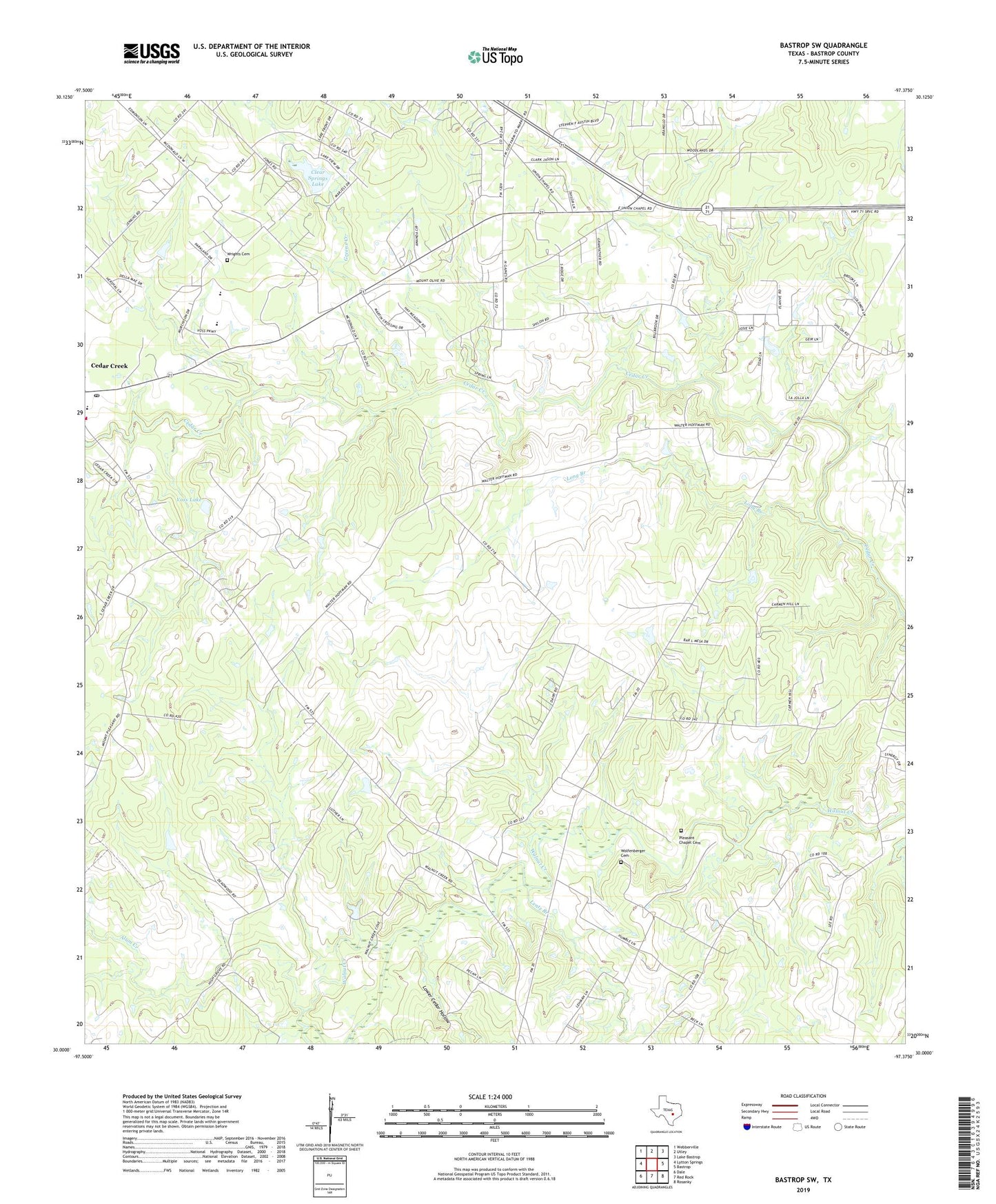
2019 topographic map quadrangle Bastrop SW in the state of Texas. Scale: 1:24000. Based on the newly updated USGS 7.5' US Topo map series, this map is in the following counties: Bastrop. The map contains contour data, water features, and other items you are used to seeing on USGS maps, but also has updated roads and other features. This is the next generation of topographic maps. Printed on high-quality waterproof paper with UV fade-resistant inks.
Quads adjacent to this one:
West: Lytton Springs
Northwest: Webberville
North: Utley
Northeast: Lake Bastrop
East: Bastrop
Southeast: Rosanky
South: Red Rock
Southwest: Dale
Contains the following named places: Alexander Eldridge Cemetery, Alum Creek, Bluebonnet Volunteer Fire Department Cedar Creek Station, Cedar Creek Post Office, Cedar Creek-Red Rock Division, Clear Springs Lake, Clear Springs Lake Dam, Elm Grove School, Greens Creek, Hopewell Church, Hopewell School, Humble Camp, Lentz Branch, Little Alum Creek, Long Branch, Long Branch School, Lower Cedar Hollow, Maha Creek, Mount Olive Church, Mount Woodrow Church, Pleasant Chapel Cemetery, Pleasant Chapel School, Shiloh, Shiloh School, Voss Lake, Voss Lake Dam, Wolfenberger Cemetery, Wrights Cemetery, ZIP Code: 78612