MyTopo
Webberville Texas US Topo Map
Couldn't load pickup availability
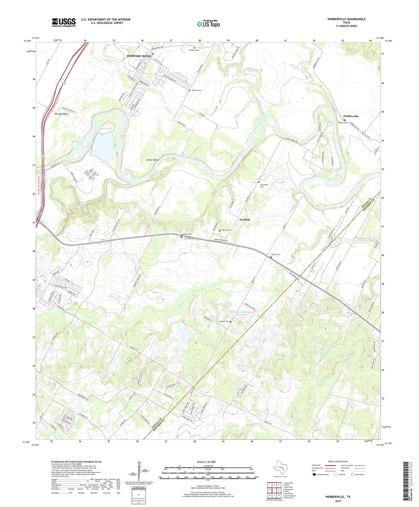
2022 topographic map quadrangle Webberville in the state of Texas. Scale: 1:24000. Based on the newly updated USGS 7.5' US Topo map series, this map is in the following counties: Travis, Bastrop. The map contains contour data, water features, and other items you are used to seeing on USGS maps, but also has updated roads and other features. This is the next generation of topographic maps. Printed on high-quality waterproof paper with UV fade-resistant inks.
Quads adjacent to this one:
West: Montopolis
Northwest: Austin East
North: Manor
Northeast: Elgin West
East: Utley
Southeast: Bastrop SW
South: Lytton Springs
Southwest: Creedmoor
This map covers the same area as the classic USGS quad with code o30097b5.
Contains the following named places: Blessed Juan Diego Catholic Church, City of Austin DBA Austin Energy Facility, City of Austin South Regional Wastewater Treatment Plant, Clarence Washington Farm Dam, Clarence Washington Farm Lake, Comanche Cemeteries, Cottonwood Church, Decker Creek, Del Valle Airport, Del Valle Junior High School, Dunlap, Elm Creek, Elysium, Fowler Cemetery, Garfield, Garfield Cemetery, Garfield Census Designated Place, Garfield Pumping Station, Garfield Wastewater Treatment Facility, Gilleland Creek, Haynie Cemetery, Haynie Chapel United Church, Hornsby Bend, Hornsby Bend Census Designated Place, Hunter Bend, Hunter Cemetery, Ingram Cemetery, Onion Creek, Puckett Cemetery, The Church of Jesus Christ of Latter Day Saints, Travis County Fire Control Emergency Services District 4 Station 1, Webberville, Webberville Village Hall, Woods Cemetery, ZIP Codes: 78617, 78725