MyTopo
Red Rock Texas US Topo Map
Couldn't load pickup availability
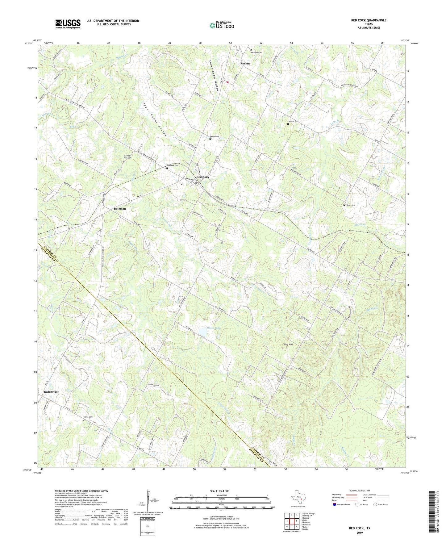
2022 topographic map quadrangle Red Rock in the state of Texas. Scale: 1:24000. Based on the newly updated USGS 7.5' US Topo map series, this map is in the following counties: Bastrop, Caldwell. The map contains contour data, water features, and other items you are used to seeing on USGS maps, but also has updated roads and other features. This is the next generation of topographic maps. Printed on high-quality waterproof paper with UV fade-resistant inks.
Quads adjacent to this one:
West: Dale
Northwest: Lytton Springs
North: Bastrop SW
Northeast: Bastrop
East: Rosanky
Southeast: Jeddo
South: Delhi
Southwest: McMahan
This map covers the same area as the classic USGS quad with code o29097h4.
Contains the following named places: Bateman, Bateman Oil Field, Bee Creek Oil Field, Carrol Lentz Oil Field, Clarks Cemetery, Elm Creek, Elm Grove, Five Points Volunteer Fire Department, Flag Hill, Hendrix Cemetery, Huber Lake, Huber Lake Dam, Lentz Cemetery, Lower Elm Creek, Meredith Family Cemetery, New Red Rock Cemetery, Old Red Rock Cemetery, Pettytown, Red Rock, Red Rock Census Designated Place, Red Rock Post Office, Rockne, Smith Cemetery, Taylorsville, Upper Cedar Hollow, Upper Elm Creek, Watterson, ZIP Code: 78662