MyTopo
Bayside Texas US Topo Map
Couldn't load pickup availability
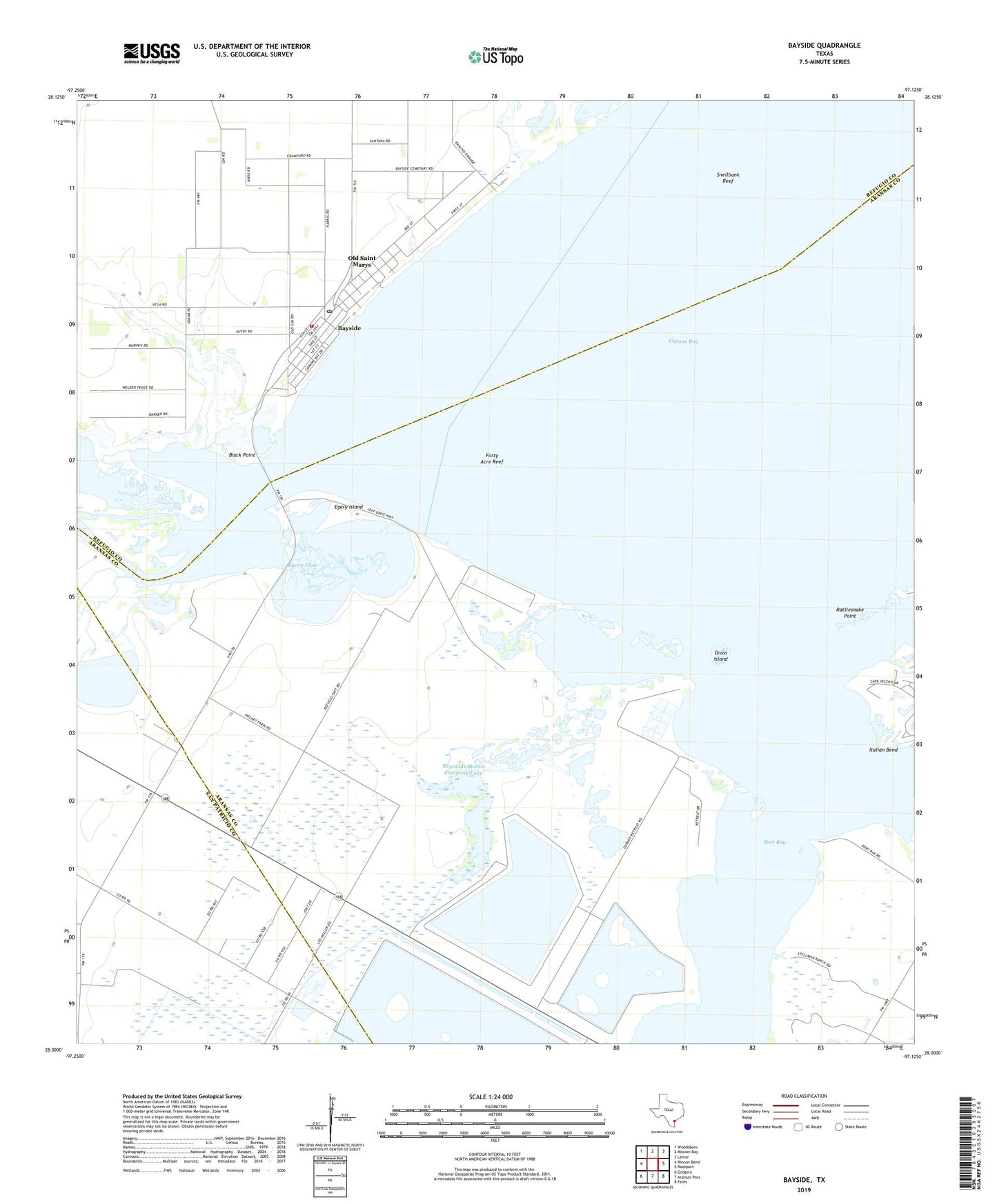
2019 topographic map quadrangle Bayside in the state of Texas. Scale: 1:24000. Based on the newly updated USGS 7.5' US Topo map series, this map is in the following counties: Aransas, Refugio, San Patricio. The map contains contour data, water features, and other items you are used to seeing on USGS maps, but also has updated roads and other features. This is the next generation of topographic maps. Printed on high-quality waterproof paper with UV fade-resistant inks.
Quads adjacent to this one:
West: Rincon Bend
Northwest: Woodsboro
North: Mission Bay
Northeast: Lamar
East: Rockport
Southeast: Estes
South: Aransas Pass
Southwest: Gregory
Contains the following named places: Aransas River, Bayside, Bayside City Hall, Bayside Post Office, Bayside Volunteer Fire Department, Bayview Estates Colonia, Black Point, Egery Flats, Egery Island, Forty Acre Reef, Fresh Water Lake, Grass Island, John Howland Wood House, Old Saint Marys, Port Bay, Rattlesnake Point, Reynolds Metals Company Dam, Reynolds Metals Company Lake, Snellbank Reef, South Copano Bay Oil Field, Swan Lake, Town of Bayside, ZIP Code: 78340