MyTopo
Woodsboro Texas US Topo Map
Couldn't load pickup availability
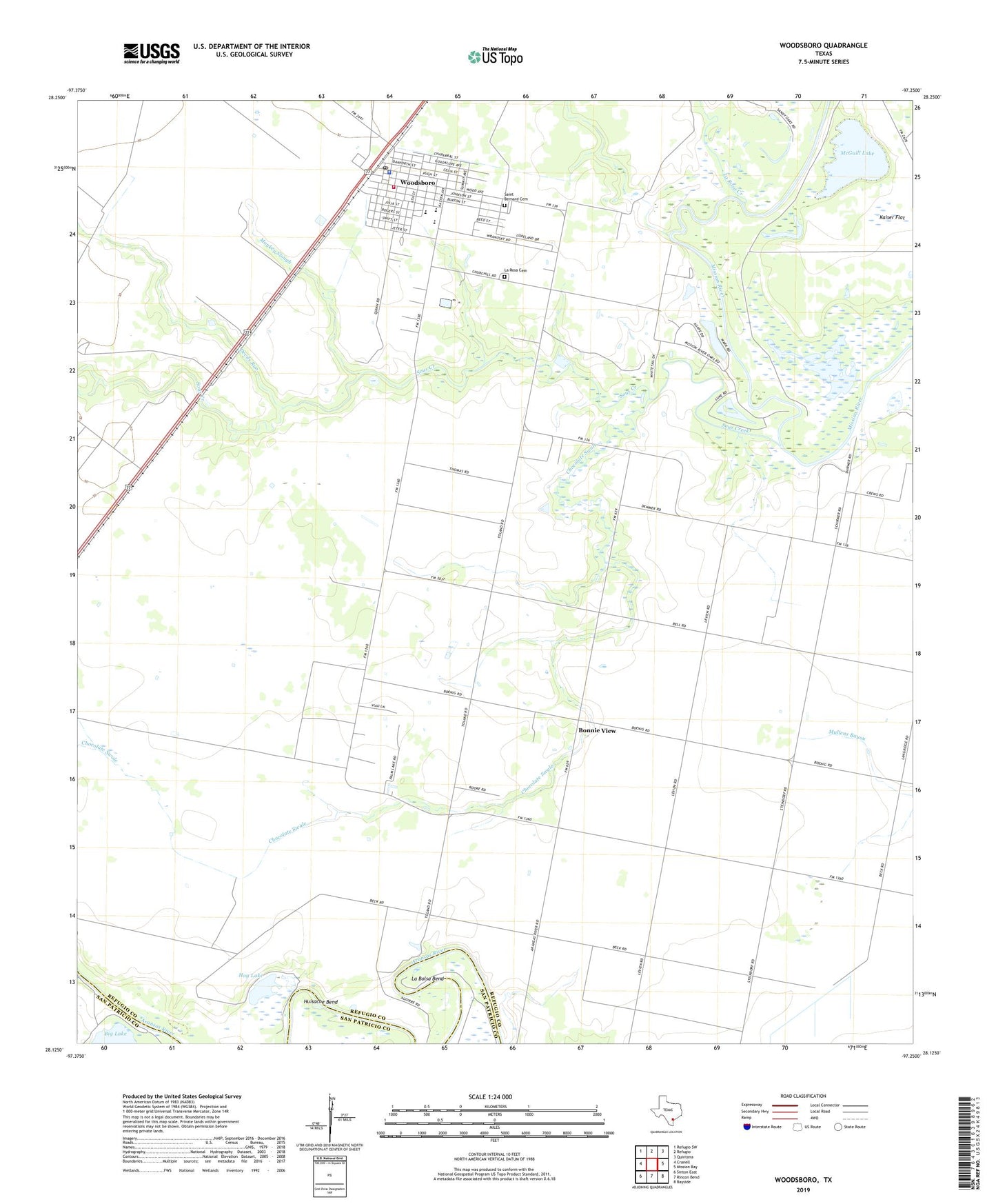
2022 topographic map quadrangle Woodsboro in the state of Texas. Scale: 1:24000. Based on the newly updated USGS 7.5' US Topo map series, this map is in the following counties: Refugio, San Patricio. The map contains contour data, water features, and other items you are used to seeing on USGS maps, but also has updated roads and other features. This is the next generation of topographic maps. Printed on high-quality waterproof paper with UV fade-resistant inks.
Quads adjacent to this one:
West: Cranell
Northwest: Refugio SW
North: Refugio
Northeast: Quintana
East: Mission Bay
Southeast: Bayside
South: Rincon Bend
Southwest: Sinton East
This map covers the same area as the classic USGS quad with code o28097b3.
Contains the following named places: Bonnie View, Bonnie View Oil Field, Chocolate Swale, Devils Run, Fennessey Flat, Hog Lake, Huisache Bend, Kaiser Flat, La Bolsa Bend, La Rosa Cemetery, La Rosa Creek, La Rosa Oil Field, Lions Park, McGuill Lake, Monkey Slough, Saint Bernard Cemetery, Sous Creek, Town of Woodsboro, Woodsboro, Woodsboro City Hall, Woodsboro Division, Woodsboro Elementary School, Woodsboro Fire Department, Woodsboro High School, Woodsboro Junior High School, Woodsboro Police Department, Woodsboro Post Office