MyTopo
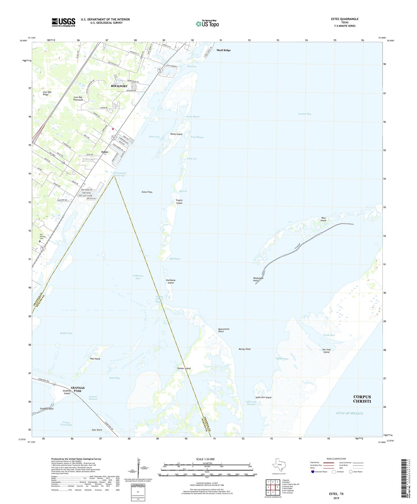
Estes Texas US Topo Map
Couldn't load pickup availability
2025 topographic map quadrangle Estes in the state of Texas. Scale: 1:24000. Based on the newly updated USGS 7.5' US Topo map series, this map is in the following counties: Aransas, Nueces. The map contains contour data, water features, and other items you are used to seeing on USGS maps, but also has updated roads and other features. This is the next generation of topographic maps. Printed on high-quality waterproof paper with UV fade-resistant inks.
Quads adjacent to this one:
West: Aransas Pass
Northwest: Bayside
North: Rockport
Northeast: Saint Charles Bay SW
East: Allyns Bight
South: Port Aransas
Southwest: Port Ingleside
This map covers the same area as the classic USGS quad with code o27097h1.
Contains the following named places: Big Bayou, Big Cut, California Hole, City of Aransas Pass, City-by-the Sea, Corpus Christi Bayou, Cove Harbor, Estes, Estes Cove, Estes Flats, Fin and Feather Marina, Hog Island, Kosmos, Little Cut, Lydia Ann Island, Middle Pass, Mobil-Rockport Heliport, Mud Island, Mudisland Point, Muray Shoal, Murray Shoal, North Pass, Old Terminal, Palm Harbor, Palm Harbor Marina, Quarantine Shore, Redfish Bay, Rockport Volunteer Fire Department South Station, San Antonio Cemetery, Shell Ridge, Shellbank Island, South Bay, Stedman Island, Talley Island, The Cove, Traylor Island, Trout Bayou, Turtle Bayou