MyTopo
Lamar Texas US Topo Map
Couldn't load pickup availability
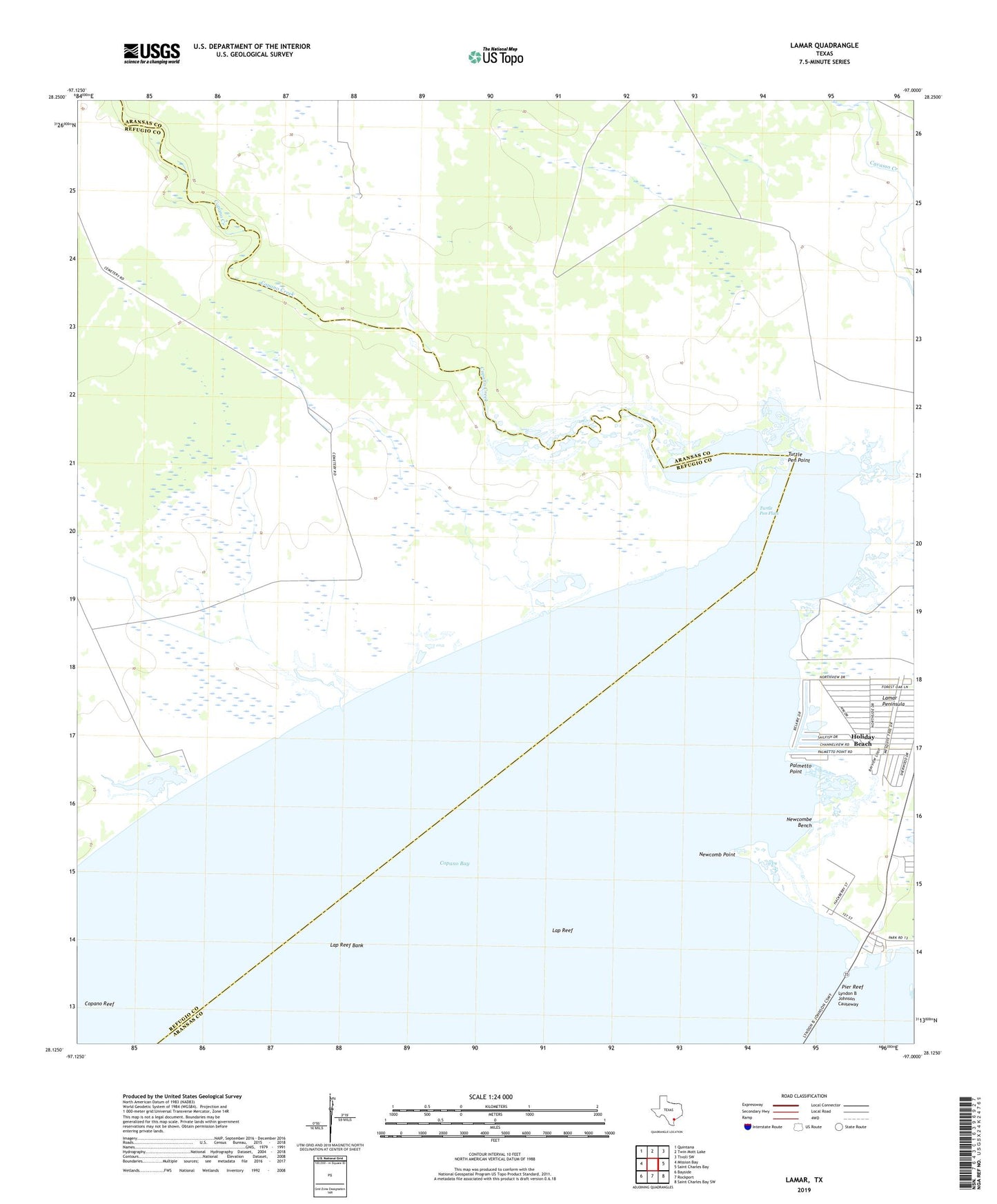
2022 topographic map quadrangle Lamar in the state of Texas. Scale: 1:24000. Based on the newly updated USGS 7.5' US Topo map series, this map is in the following counties: Aransas, Refugio. The map contains contour data, water features, and other items you are used to seeing on USGS maps, but also has updated roads and other features. This is the next generation of topographic maps. Printed on high-quality waterproof paper with UV fade-resistant inks.
Quads adjacent to this one:
West: Mission Bay
Northwest: Quintana
North: Twin Mott Lake
Northeast: Tivoli SW
East: Saint Charles Bay
Southeast: Saint Charles Bay SW
South: Rockport
Southwest: Bayside
This map covers the same area as the classic USGS quad with code o28097b1.
Contains the following named places: Copano Bay Oil and Gas Field, Copano Creek, Hackberry Well, Heard Well, Holiday Beach, Holiday Beach Census Designated Place, Lamar, Lap Reef, Lap Reef Bank, Long Well, Madero Well, Newcomb Point, Newcombe Bench, Palmetto Point, Pier Reef, Plumbers Slough, Plumbers Well, Sand Well, Schultz Well, Turtle Pen Flats, Turtle Pen Point, ZIP Code: 78382