MyTopo
Bazette Texas US Topo Map
Couldn't load pickup availability
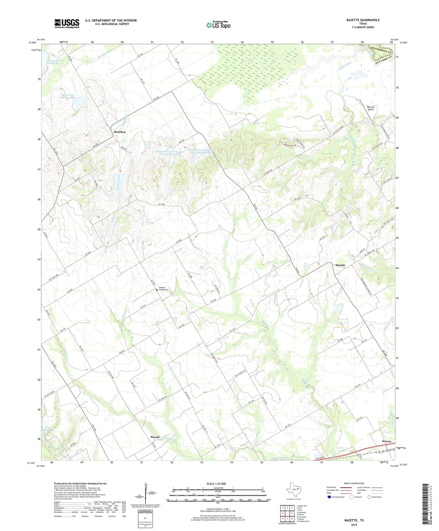
2019 topographic map quadrangle Bazette in the state of Texas. Scale: 1:24000. Based on the newly updated USGS 7.5' US Topo map series, this map is in the following counties: Navarro, Henderson. The map contains contour data, water features, and other items you are used to seeing on USGS maps, but also has updated roads and other features. This is the next generation of topographic maps. Printed on high-quality waterproof paper with UV fade-resistant inks.
Quads adjacent to this one:
West: Chatfield
Northwest: Rosser SW
North: Styx
Northeast: Tool
East: Kerens
Southeast: Goodlow Park
South: Powell
Southwest: Corsicana
Contains the following named places: Bazette, Bazette-Prairie Point Church, Fair Acres Branch, Goodhope Church, Hancock Airport, Montfort, Reservoir Number Eight, Reservoir Number Nine, Reservoir Number Six, Roane Church, Smith Airport, Soil Conservation Service Site 103 Dam, Soil Conservation Service Site 103 Reservoir, Soil Conservation Service Site 104 Dam, Soil Conservation Service Site 104 Reservoir, Soil Conservation Service Site 105 Dam, Soil Conservation Service Site 105 Reservoir, Soil Conservation Service Site 6 Dam, Soil Conservation Service Site 8 Dam, Soil Conservation Service Site 9 Dam, Soil Conservation Service Site 9 Reservoir, Wesleys Chapel Cemetery, Westbrook Creek, ZIP Code: 75153