MyTopo
Tool Texas US Topo Map
Couldn't load pickup availability
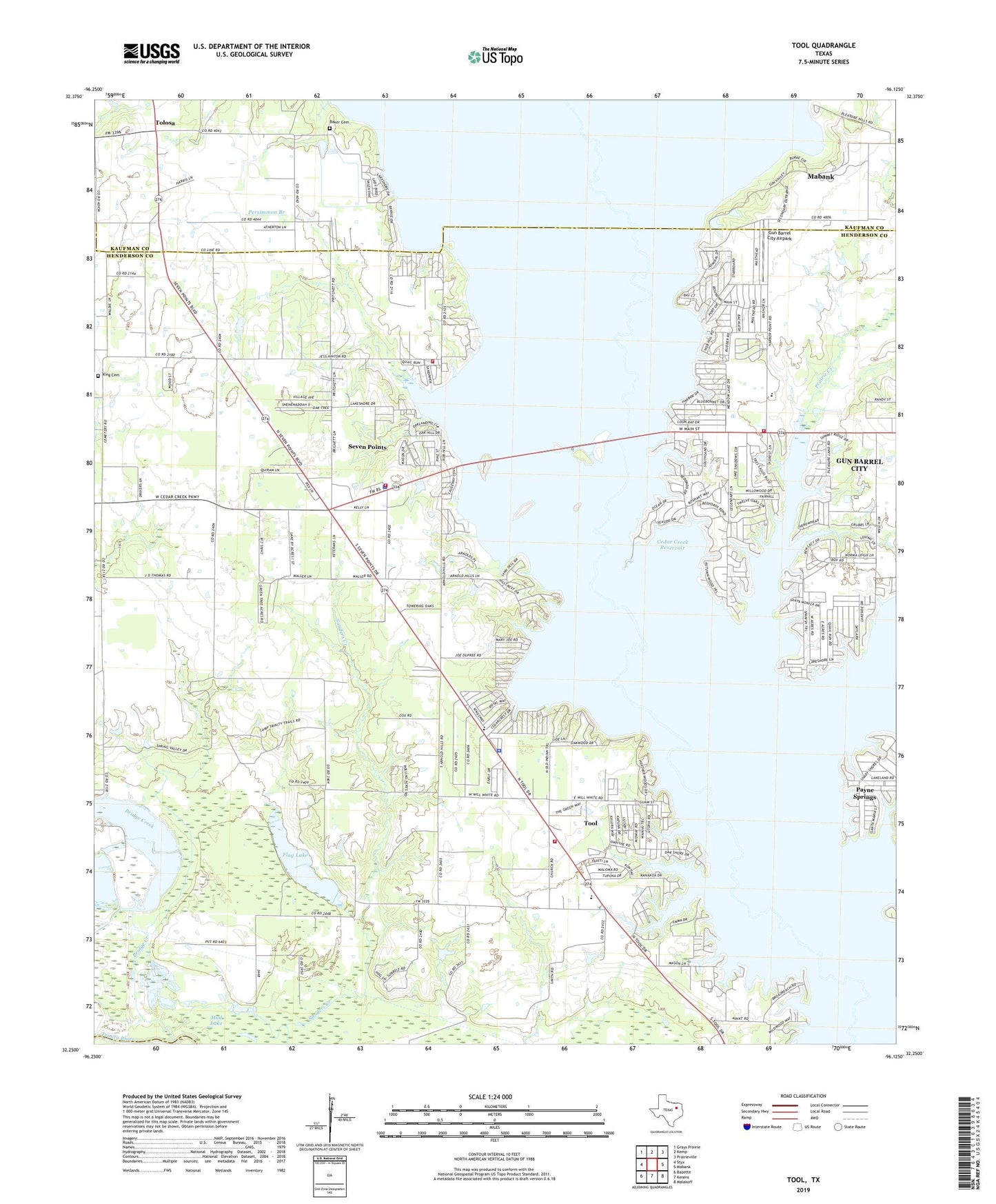
2022 topographic map quadrangle Tool in the state of Texas. Scale: 1:24000. Based on the newly updated USGS 7.5' US Topo map series, this map is in the following counties: Henderson, Kaufman, Navarro. The map contains contour data, water features, and other items you are used to seeing on USGS maps, but also has updated roads and other features. This is the next generation of topographic maps. Printed on high-quality waterproof paper with UV fade-resistant inks.
Quads adjacent to this one:
West: Styx
Northwest: Grays Prairie
North: Kemp
Northeast: Prairieville
East: Mabank
Southeast: Malakoff
South: Kerens
Southwest: Bazette
This map covers the same area as the classic USGS quad with code o32096c2.
Contains the following named places: Aley, Baker Cemetery, Bridge Creek, Calvary Church, Cedar Creek Reservoir, Cedar Creek Wildlife Management Area - Bird Island Unt, Cedar Creek Wildlife Management Area - Telfair Island Unit, City of Gun Barrel City, City of Seven Points, City of Tool, Disciple Baptist Church, Flag Lake, Flag Lake Church, Flag Lake Oil Field, Gun Barrel City, Gun Barrel City Airpark, Gun Barrel City Fire Department Substation, Gun Barrel City Hall, Henderson County Constable's Office Precinct 2, King Cemetery, Lacy Fork, Lakeview Elementary School, Mud Lake, Persimmon Branch, Prairie Creek, Providence Church, Seven Points, Seven Points City Hall, Seven Points Police Department, Seven Points Volunteer Fire Department, Seven Points Volunteer Fire Department Substation, Tolosa, Tool, Tool City Hall, Tool Police Department, Tool Volunteer Fire Department, ZIP Code: 75143