MyTopo
Rosser SW Texas US Topo Map
Couldn't load pickup availability
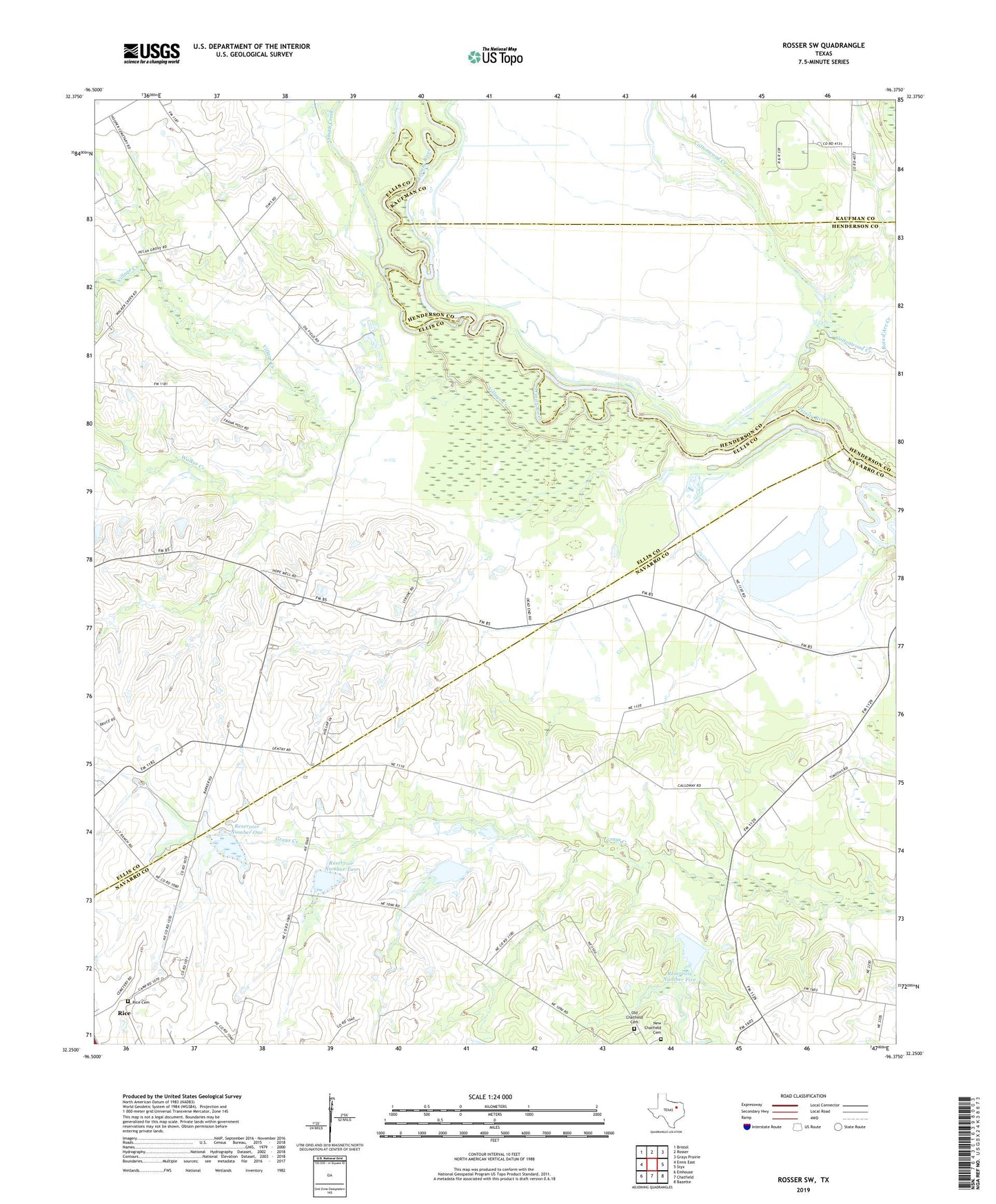
2022 topographic map quadrangle Rosser SW in the state of Texas. Scale: 1:24000. Based on the newly updated USGS 7.5' US Topo map series, this map is in the following counties: Navarro, Ellis, Henderson, Kaufman. The map contains contour data, water features, and other items you are used to seeing on USGS maps, but also has updated roads and other features. This is the next generation of topographic maps. Printed on high-quality waterproof paper with UV fade-resistant inks.
Quads adjacent to this one:
West: Ennis East
Northwest: Bristol
North: Rosser
Northeast: Grays Prairie
East: Styx
Southeast: Bazette
South: Chatfield
Southwest: Emhouse
This map covers the same area as the classic USGS quad with code o32096c4.
Contains the following named places: Clubhouse Farm, Cottonwood Creek, Hopewell Church, New Chatfield Cemetery, Old Chatfield Cemetery, Reservoir Number Five, Reservoir Number One, Reservoir Number Three, Reservoir Number Two, Rice Cemetery, Rice Oil Field, Skylark Airport, Smith Creek, Soil Conservation Service Site 1 Dam, Soil Conservation Service Site 2 Dam, Soil Conservation Service Site 3 Dam, Soil Conservation Service Site 4 Dam, Soil Conservation Service Site 5 Dam, Soil Conservation Service Site 5 Reservoir, Valley Farms, Village Creek, Walker Creek, ZIP Code: 75105