MyTopo
Beech Grove Texas US Topo Map
Couldn't load pickup availability
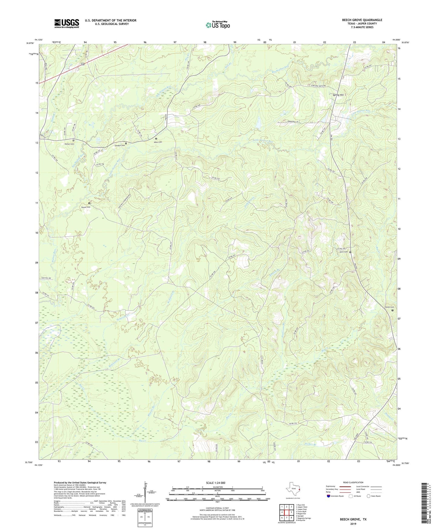
2019 topographic map quadrangle Beech Grove in the state of Texas. Scale: 1:24000. Based on the newly updated USGS 7.5' US Topo map series, this map is in the following counties: Jasper. The map contains contour data, water features, and other items you are used to seeing on USGS maps, but also has updated roads and other features. This is the next generation of topographic maps. Printed on high-quality waterproof paper with UV fade-resistant inks.
Quads adjacent to this one:
West: Town Bluff
Northwest: Pace Hill
North: Jasper West
Northeast: Jasper East
East: Roganville
Southeast: Kirbyville
South: Magnolia Springs
Southwest: Spurger
Contains the following named places: Allen Cemetery, Beech Grove, Big Walnut Run, Blewett Branch, Dry Branch, Dunn Cemetery, George Washington Smyth Historical Monument, Holton Cemetery, Hurricane Branch, Little Walnut Run, Mill Branch, Oak Hill, Pickering Creek, Robinson Branch, Sanders Cemetery, Science Hall, Smith Cemetery, Smyth Cemetery, Spring Hill