MyTopo
Kirbyville Texas US Topo Map
Couldn't load pickup availability
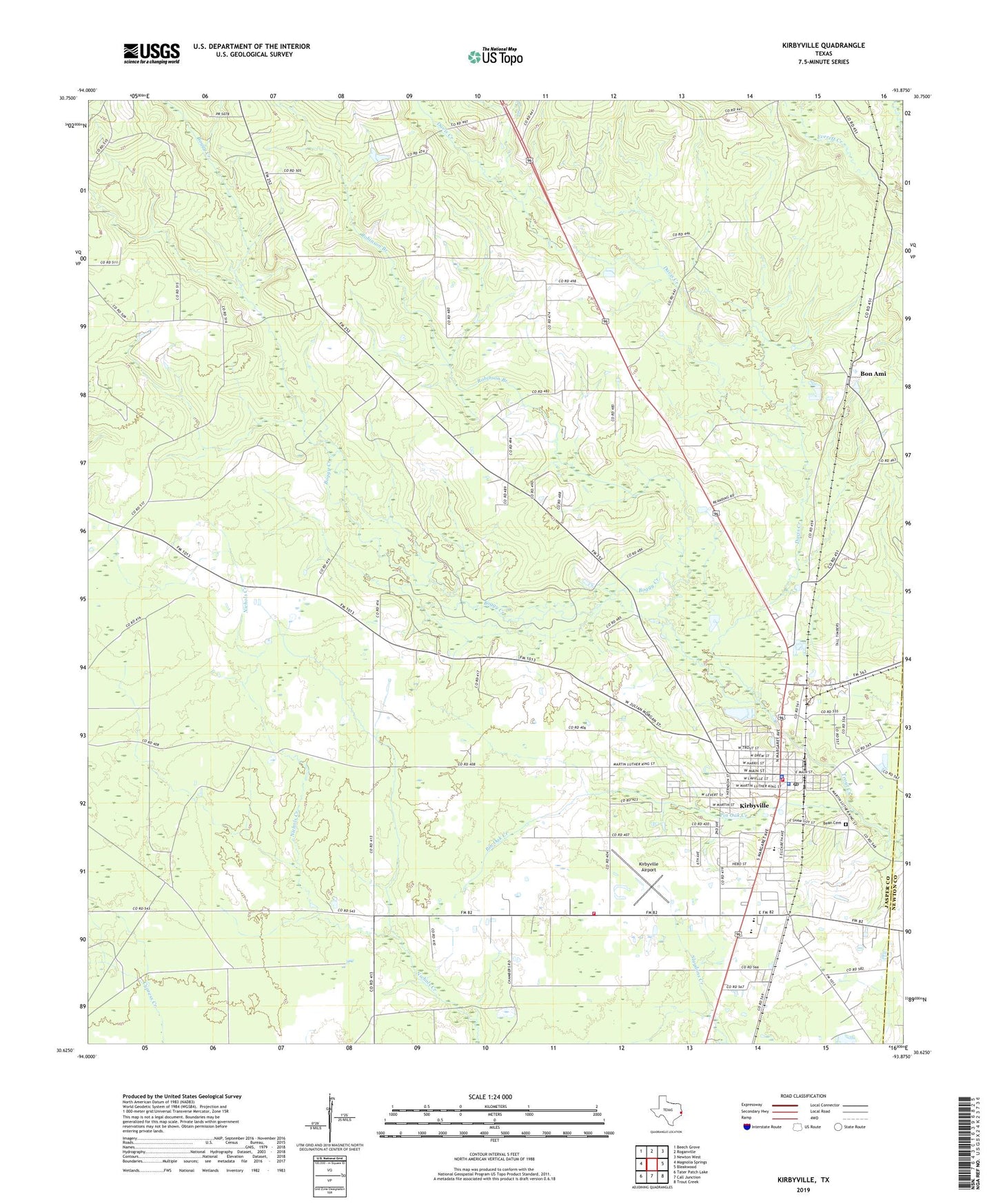
2022 topographic map quadrangle Kirbyville in the state of Texas. Scale: 1:24000. Based on the newly updated USGS 7.5' US Topo map series, this map is in the following counties: Jasper, Newton. The map contains contour data, water features, and other items you are used to seeing on USGS maps, but also has updated roads and other features. This is the next generation of topographic maps. Printed on high-quality waterproof paper with UV fade-resistant inks.
Quads adjacent to this one:
West: Magnolia Springs
Northwest: Beech Grove
North: Roganville
Northeast: Newton West
East: Bleakwood
Southeast: Trout Creek
South: Call Junction
Southwest: Tater Patch Lake
This map covers the same area as the classic USGS quad with code o30093f8.
Contains the following named places: Bean Cemetery, Boggy Creek, Bon Ami, City of Kirbyville, Colemans Chapel Church, Davis Creek, First Baptist Church, J and E Junction, Jasper County Constable's Office Precinct 3, Jasper County Sheriff's Office, Kirbyville, Kirbyville Airport, Kirbyville City Hall, Kirbyville Division, Kirbyville Elementary School, Kirbyville High School, Kirbyville Junior High School, Kirbyville Police Department, Kirbyville Post Office, Kirbyville United Pentecostal Church, Kirbyville Volunteer Fire Department, Light House Church of God in Christ, Mount Zion Church, New Deliverance Church of God, North Antioch Church, Pin Oak Creek, Robinson Branch, Texas Forest Service Kirbyville Office, United Methodist Church, ZIP Code: 75956