MyTopo
Big Heiser Tank Texas US Topo Map
Couldn't load pickup availability
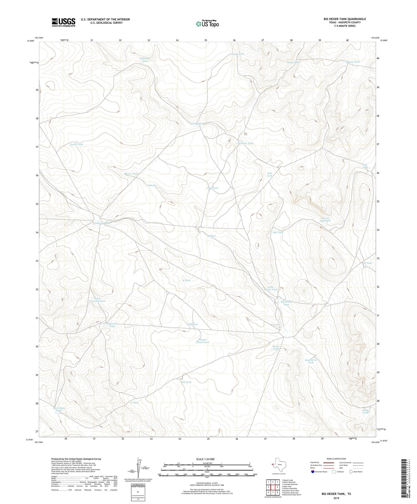
2019 topographic map quadrangle Big Heiser Tank in the state of Texas. Scale: 1:24000. Based on the newly updated USGS 7.5' US Topo map series, this map is in the following counties: Hudspeth. The map contains contour data, water features, and other items you are used to seeing on USGS maps, but also has updated roads and other features. This is the next generation of topographic maps. Printed on high-quality waterproof paper with UV fade-resistant inks.
Quads adjacent to this one:
West: Hobo Tank
Northwest: Bassett Lake
North: Alamo Mountain
Northeast: Cornudas Mountain
East: Sixteen Mountains
Southeast: Molesworth Mesa North
South: Buckhorn Draw East
Southwest: Buckhorn Draw West
Contains the following named places: Alamo Tank, Big Heiser Tank, Boats Tank, Bull Tank, C Tank, Cat Tank, Cherry Tank, D Tank, Dead Horse Tank, East F Tank, Eightmile Tank, Fivemile Tank, Fourmile Tank, House Tank, Johnson Tank, Kerr Ranch, L Tank, Lake Tank, Little Heiser Tank, Lost Valley Tank, North Fourmile Tank, O Tank, Prairie Dog Tank, Sheep Tank, Sixmile Tank, W Tank, Wagon Wheel Tank, Well Tank, West L Tank