MyTopo
Blanchard Texas US Topo Map
Couldn't load pickup availability
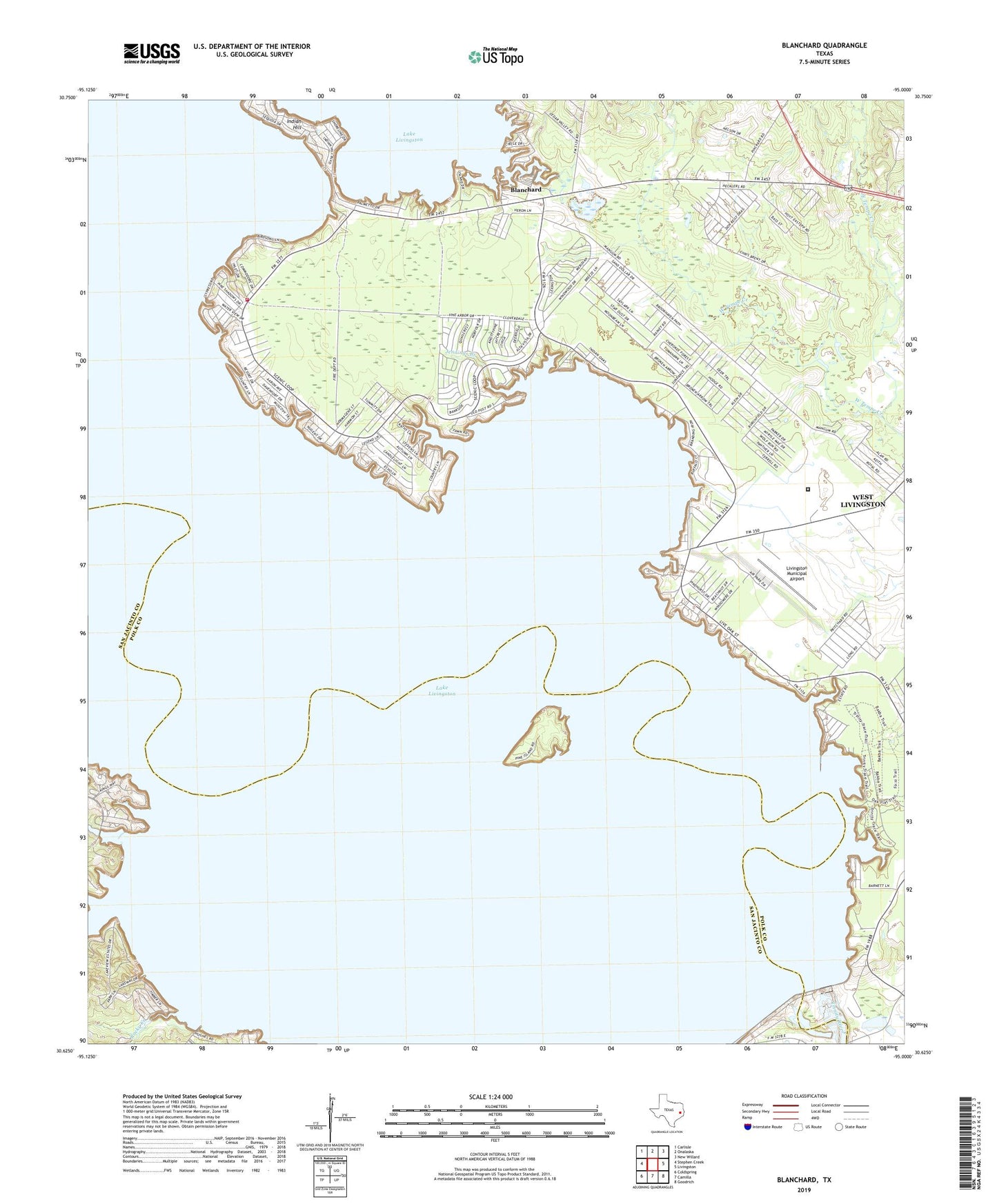
2019 topographic map quadrangle Blanchard in the state of Texas. Scale: 1:24000. Based on the newly updated USGS 7.5' US Topo map series, this map is in the following counties: Polk, San Jacinto. The map contains contour data, water features, and other items you are used to seeing on USGS maps, but also has updated roads and other features. This is the next generation of topographic maps. Printed on high-quality waterproof paper with UV fade-resistant inks.
Quads adjacent to this one:
West: Stephen Creek
Northwest: Carlisle
North: Onalaska
Northeast: New Willard
East: Livingston
Southeast: Goodrich
South: Camilla
Southwest: Coldspring
Contains the following named places: Black Branch, Blanchard, East Tempe Creek, Garner Chapel, Indian Branch, Indian Creek, Indian Hill, Jennings Branch, Lake Livingston State Park, Lake Livingston State Park Trail, Livingston Dam, Livingston Municipal Airport, Moore Hill, Rocky Creek, Scenic Loop Volunteer Fire Department, Swartout, Texas Department of Criminal Justice Allan B Polunsky Unit, Tigerville, Tobacco Patch, West Livingston, West Livingston Census Designated Place, West Tempe Creek