MyTopo
Carlisle Texas US Topo Map
Couldn't load pickup availability
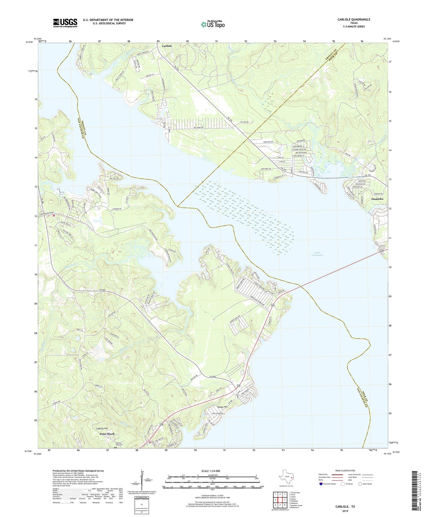
2022 topographic map quadrangle Carlisle in the state of Texas. Scale: 1:24000. Based on the newly updated USGS 7.5' US Topo map series, this map is in the following counties: San Jacinto, Polk, Trinity. The map contains contour data, water features, and other items you are used to seeing on USGS maps, but also has updated roads and other features. This is the next generation of topographic maps. Printed on high-quality waterproof paper with UV fade-resistant inks.
Quads adjacent to this one:
West: Staley
Northwest: Trinity East
North: Chita
Northeast: Colita
East: Onalaska
Southeast: Blanchard
South: Stephen Creek
Southwest: Oakhurst
This map covers the same area as the classic USGS quad with code o30095g2.
Contains the following named places: Big Branch, Brushy Creek, Caney Creek, Carlisle, Clear Creek, Darby Hill, Darby Hill Church, Harts Creek, Kickapoo Creek, Lake Livingston, Liberty Hill, Liberty Hill Cemetery, Open Bottom Creek, Palmetto Creek, Pine Valley Church, Point Blank Division, Point Blank Volunteer Fire Department, Pointblank School, Rocky Creek, Waterwood, Waterwood Volunteer Fire Department, ZIP Code: 77364